Cardiganshire Family History Society, Cymdeithas Hanes Teuluoedd Ceredigion
Books and Maps / Maps
Published by Alan Godfrey
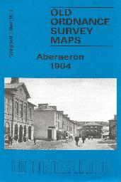
Aberaeron Town Plan (1904)
A detailed plan of Aberaeron at the start of the 20th century
Supplied by: Cardiganshire Family History Society, Cymdeithas Hanes Teuluoedd Ceredigion Product Ref: CGN-W19
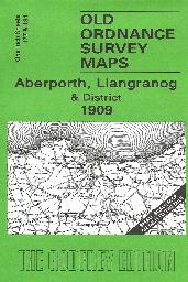
Aberporth, Llangranog and District (1909)
Sheet 177/194, showing the coastal area from Aberaeron to Llangranog (1909 edition)
Supplied by: Cardiganshire Family History Society, Cymdeithas Hanes Teuluoedd Ceredigion Product Ref: CGN-W16
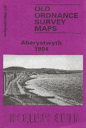
Aberystwyth - Town Plan (1904)
A detailed plan of Aberystwyth town at the start of the 20th century. On the reverse is some history of Aberystwyth with a list of residents and traders.
Supplied by: Cardiganshire Family History Society, Cymdeithas Hanes Teuluoedd Ceredigion Product Ref: CGN-W13
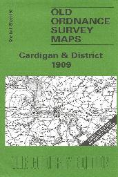
Cardigan & District (1909)
Sheet 193 showing Cardigan and the neighbouring area
Supplied by: Cardiganshire Family History Society, Cymdeithas Hanes Teuluoedd Ceredigion Product Ref: CGN-W17
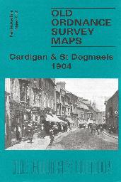
Cardigan & St Dogmaels (1904)
Shhe 2.12. The town of Cardigan is in the top right corner and features here include the town centre, including High Street, Priory Street, part of Pendre, Cardigan Bridge, castle remains, Custom House, malthouses, Bridgend, Station Road (but actual station is just off the map). The map then extends westward to St Dogmells (or Dogmaels, or Llandudoch) in Pembrokeshire; features here include St Thomas…
Supplied by: Cardiganshire Family History Society, Cymdeithas Hanes Teuluoedd Ceredigion Product Ref: CGN-W20
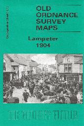
Lampeter - Town Plan (1904)
A detailed plan of Lampeter town at the start of the 20th century. On the reverse is some history of Lampeter with a list of residents and traders.
Supplied by: Cardiganshire Family History Society, Cymdeithas Hanes Teuluoedd Ceredigion Product Ref: CGN-W14
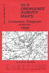
Lampeter, Tregaron & District (1909)
Showing the area around Lampeter. and Tregaron. On the reverse side is a plan of Tregaron with a list of traders, farmers etc.
Supplied by: Cardiganshire Family History Society, Cymdeithas Hanes Teuluoedd Ceredigion Product Ref: CGN-W11
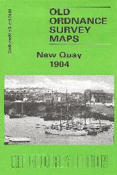
Newquay Town Plan (1904)
A detailed plan of Newquay at the start of the 20th century
Supplied by: Cardiganshire Family History Society, Cymdeithas Hanes Teuluoedd Ceredigion Product Ref: CGN-W18
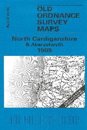
North Cardiganshire & Aberystwyth (1909)
Sheet 163, showing the area around Aberystwyth, Aberdovey and the Dovey estuary. On the reverse is a large scale plan of Borth in 1904, and an essay on the history of the area by Alan Leather.
Supplied by: Cardiganshire Family History Society, Cymdeithas Hanes Teuluoedd Ceredigion Product Ref: CGN-W09
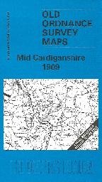
Old Ordnance Survey one-inch Map. - Mid Cardiganshire (1909)
Sheet 178, showing the area around Llanrhystud, Llanilar, Strata Florida and Devil's Bridge. On the reverse is a large scale plan of Llanrhystud in 1904, and an essay on the history of the area by Alan Leather.
Supplied by: Cardiganshire Family History Society, Cymdeithas Hanes Teuluoedd Ceredigion Product Ref: CGN-W10