Product Search
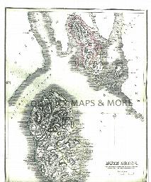
Bristol 1866 A3 Map
detailed coloured street map [sent in tube]
Supplied by: The Mclaughlin Guides and Buckinghamshire related books and historic maps Product Ref: BGS-M11
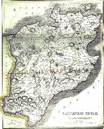
Bristol c.1895 Map CD
Stepping Stones publication Bristol c.1895 Map CD
Supplied by: S&N Genealogy Supplies Product Ref: SNG-5089
Brough 1908
Dated 1908. Sheet 238.08. 25in to the mile This detailed map covers the village of Brough, originally within the parish of Elloughton. The two had a combined population of just 1009 in 1901 but this would grow massively in the 20th century, following the building of a factory by the Blackburn Aeroplane & Motor Co in 1916. In 1908, however, this remained a somewhat straggling village and this map covers…
Supplied by: East Yorkshire Family History Society Product Ref: EYK-G002-GM1
Broughton (Village Booklet 35)
The village of Broughton and the parish of St. Mary the Virgin.
Supplied by: Hampshire Genealogical Society Product Ref: HAM-16035
Brown & Chilton Candover (Village Booklet 30)
The villages of Brown and Chilton Candover and the parish of St. Peter.
Supplied by: Hampshire Genealogical Society Product Ref: HAM-16030
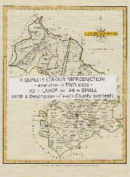
BUCKINGHAMSHIRE 1787
A QUALITY A3 SIZE COLOUR REPRODUCTION FROM JOHN CARY'S 1787 ATLAS WITH DETAILS OF THE COUNTY OVERLEAF. LASER PRINTER ON GOOD QUALITY CARTRIDGE PAPER. SENT FOLDED IN A PLASTIC DISPLAY SLEEVE IN A STIFF CARD ENVELOPE AT THE LARGE LETTER RATE. SCALES VARY
Supplied by: Quality Maps and More Product Ref: QMM-MP103
Buckinghamshire Map 1837
A3 size Full colour of the county [sent in tube]
Supplied by: The Mclaughlin Guides and Buckinghamshire related books and historic maps Product Ref: BGS-B14
Buckinghamshire Parish Map A3 size
Map for marking off places researched - ample room for name entry [sent in tube]
Supplied by: The Mclaughlin Guides and Buckinghamshire related books and historic maps Product Ref: BGS-B9
Buckinghamshire Parish Map A4 size
Map for marking off places researched
Supplied by: The Mclaughlin Guides and Buckinghamshire related books and historic maps Product Ref: BGS-B8
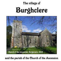
Burghclere (Village Booklet 106)
The Village of Burghclere and the Parish Church of the Ascension
Supplied by: Hampshire Genealogical Society Product Ref: HAM-16106
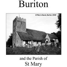
Buriton (Village Booklet 14)
The village of Buriton and the parish of St. Mary.
Supplied by: Hampshire Genealogical Society Product Ref: HAM-16014
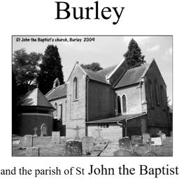
Burley (Village Booklet 34)
The village of Burley and the parish of St. John the Baptist.
Supplied by: Hampshire Genealogical Society Product Ref: HAM-16034
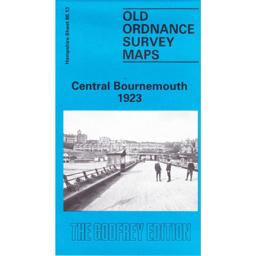
Burnemouth Central 1923
Covers the coastline of Bournemouth and Boscombe. The reverse is a larger scale of part of Southern Hampshire. Wilthshire and the IOW. The historical noted are by Alan Godfrey.
Supplied by: Hampshire Genealogical Society Product Ref: HAM-13966711
BUTE 1845
A QUALITY A3 SIZE COLOUR REPRODUCTION FROM THE NEW STATISTICAL ACCOUNT OF SCOTLAND 1845. MOST MAPS HAVE THE PARISHES OUTLINED LASER PRINTER ON GOOD QUALITY CARTRIDGE PAPER. SENT FOLDED IN A PLASTIC DISPLAY SLEEVE IN A STIFF CARD ENVELOPE AT THE LARGE LETTER RATE. SCALES VARY [WATERMARKS WILL NOT SHOW ON PURCHASES]
Supplied by: Quality Maps and More Product Ref: QMM-MP306
Caernarvon 1834 A3 Map
detailed coloured street map [sent in tube]
Supplied by: The Mclaughlin Guides and Buckinghamshire related books and historic maps Product Ref: BGS-M12
CAITHNESS 1845
A QUALITY A3 SIZE COLOUR REPRODUCTION FROM THE NEW STATISTICAL ACCOUNT OF SCOTLAND 1845. MOST MAPS HAVE THE PARISHES OUTLINED LASER PRINTER ON GOOD QUALITY CARTRIDGE PAPER. SENT FOLDED IN A PLASTIC DISPLAY SLEEVE IN A STIFF CARD ENVELOPE AT THE LARGE LETTER RATE. SCALES VARY [WATERMARKS WILL NOT SHOW ON PURCHASES]
Supplied by: Quality Maps and More Product Ref: QMM-MP307
Cambridge 1801 A3 Map
detailed coloured street map [sent in tube]
Supplied by: The Mclaughlin Guides and Buckinghamshire related books and historic maps Product Ref: BGS-M13
Cambridge 1837 A3 Map
detailed coloured street map [sent in tube]
Supplied by: The Mclaughlin Guides and Buckinghamshire related books and historic maps Product Ref: BGS-M14
Cambridge c.1890 Map CD
Stepping Stones publication Cambridge c.1890 Map CD
Supplied by: S&N Genealogy Supplies Product Ref: SNG-5092
CAMBRIDGESHIRE 1787
A QUALITY A3 SIZE COLOUR REPRODUCTION FROM JOHN CARY'S 1787 ATLAS WITH DETAILS OF THE COUNTY OVERLEAF. LASER PRINTER ON GOOD QUALITY CARTRIDGE PAPER. SENT FOLDED IN A PLASTIC DISPLAY SLEEVE IN A STIFF CARD ENVELOPE AT THE LARGE LETTER RATE. SCALES VARY
Supplied by: Quality Maps and More Product Ref: QMM-MP104
Cambridgeshire 1837 A3 County Map
detailed coloured county map [sent in tube]
Supplied by: The Mclaughlin Guides and Buckinghamshire related books and historic maps Product Ref: BGS-M64
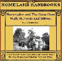
Cambridgeshire, The Homeland Handbooks - Huntingdon and The Great Ouse with St. Neots and St. Ives (1905 Ordnance Map)
This guide provides invaluable background information on Huntingdon and The Great Ouse with St. Neots and St. Ives in the 1900's. This official council guide has maps, photographs and illustrations. It covers the history, traditions, worthies, antiquities and literary associations. This is a useful guide with information and details about the area where your relatives may have lived. \*Digitally…
Supplied by: S&N Genealogy Supplies Product Ref: SNG-3683
Canterbury 1801 A3 Map
detailed coloured street map [sent in tube]
Supplied by: The Mclaughlin Guides and Buckinghamshire related books and historic maps Product Ref: BGS-M15
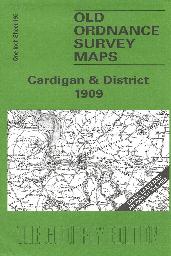
Cardigan & District (1909)
Sheet 193 showing Cardigan and the neighbouring area
Supplied by: Cardiganshire Family History Society, Cymdeithas Hanes Teuluoedd Ceredigion Product Ref: CGN-W17
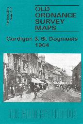
Cardigan & St Dogmaels (1904)
Shhe 2.12. The town of Cardigan is in the top right corner and features here include the town centre, including High Street, Priory Street, part of Pendre, Cardigan Bridge, castle remains, Custom House, malthouses, Bridgend, Station Road (but actual station is just off the map). The map then extends westward to St Dogmells (or Dogmaels, or Llandudoch) in Pembrokeshire; features here include St Thomas…
Supplied by: Cardiganshire Family History Society, Cymdeithas Hanes Teuluoedd Ceredigion Product Ref: CGN-W20