Product Search
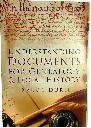
Understanding Documents for Genealogy and Local History by Bruce Durie
This book details how to find and comprehend documents from 1560 to the 1860s, including wills, testaments, contracts, land records, official records, deeds, and more. The Latin glossary is especially useful for helping translate any Latin documents. Genealogists and local historians have probably seen every birth, marriage, death and census record available, and are adept at using the internet for…
Supplied by: S&N Genealogy Supplies Product Ref: SNG-6252
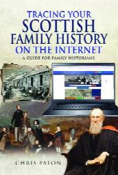
Tracing Your Scottish Family History on the Internet by Chris Paton
A practical guide to researching Scottish ancestry using the Internet. * Chapters on many classes of records and online offerings sourced nationally and from every Scottish county * Covers national institutions, commercial sites and sources generated by local Family History Societies and individuals * Explains how these sources can be understood and related to individual research projects * Examines…
Supplied by: S&N Genealogy Supplies Product Ref: SNG-6771
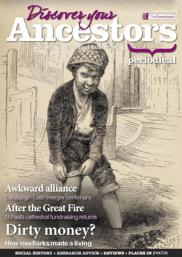
Discover Your Ancestors Periodical - Issue 91 (November 2020)
Keep up to date with the genealogy world and learn more about your hobby with the critically acclaimed Discover Your Ancestors online periodical. Whether you are just starting out or have reached a brick wall in your research, this will help and inspire you on your family history journey. Receive guidance from experts, tips on the best sources for records, explore connections around the world and bring…
Supplied by: S&N Genealogy Supplies Product Ref: SNG-7007
Doncaster St George
First Published September 2013 Latest Revision July 2022 Information includes: Doncaster St George Baptisms 1557 to 1935 Burials 1557 to 1890 Marriages 1557 to 1941 Please Note The marriage records February 1848 to March 1853 are missing, because the Church suffered from fire damage in February 1853 and these records were destroyed in the fire. Some baptism and some burial records were also lost. Others Yards…
Supplied by: Doncaster and District Family History Society Product Ref: DON-1081
CD13 Wiltshire Confirmations 1703-1920
The confirmations in this publication, with the exception of Bromham, which is still held by the Church, are deposited in Wiltshire & Swindon History Centre. Over 3,000 records, all for the year 1787, are in the Diocesan records. The rest are in the parish records, some of which are in specially printed books and a few in parish registers. Candidates may not have been confirmed in the parish…
Supplied by: Wiltshire Family History Society Product Ref: WIL-CD13
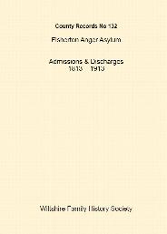
CS132 - Fisherton Anger Asylum Admissions & Discharges 1813 – 1913
A4 paperback. 490pp The Wiltshire and Swindon History Centre (WSHC) holds records for a number of asylums that were in operation from the late 19th century in Wiltshire. The quantity and scope of the records vary between institutions. These records are for: Fisherton Anger Wilts, Lunatic Asylum. 1813 – 1913 A register or list of the several patients under the care of Mr Charles Finch at his house at…
Supplied by: Wiltshire Family History Society Product Ref: WIL-CS132
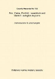
CS133 - Box, Calne, Fonthill, Laverstock and Market Lavington Asylums Admissions & Discharges
A4 paperback - 196pp The Wiltshire and Swindon History Centre (WSHC) holds records for a number of asylums that were in operation from the late 19th century in Wiltshire. The quantity and scope of the records vary between institutions. The records for this publication are for : Box – Kingsdown House. 1792 – 1919 A Register or List of the several Patients confined in the House of Dr Charles Cunningham…
Supplied by: Wiltshire Family History Society Product Ref: WIL-CS133
Yorkshire Probate by Colin Blanshard Withers
The Family History Show Special Offer *** Now less than half price! RRP £35 *** Probate is both the most frustrating and the most rewarding source a genealogist can discover. Frustrating because of its complexity, particularly in the Diocese of York, and rewarding because it can unlock the personalities, likes, dislikes and personal relations of our ancestors. Where else could you discover that a seventeenth-century…
Supplied by: Yorkshire Ancestors Product Ref: YAN-PROB
Yorkshire Probate by Colin Blanshard Withers
Probate is both the most frustrating and the most rewarding source a genealogist can discover. Frustrating because of its complexity, particularly in the Diocese of York, and rewarding because it can unlock the personalities, likes, dislikes and personal relations of our ancestors. Where else could you discover that a seventeenth-century clergyman's son had ridden up to his father's house in the dead…
Supplied by: Ryedale Family History Group Product Ref: RFH-misc-bk022
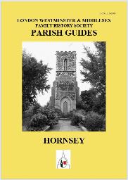
Hornsey
This booklet contains a list of the main records of interest to the genealogical researcher for the area based on the ancient parish of Hornsey and includes the districts of Crouch End, Finsbury Park, Fortis Green, Harringay, Highgate, Hornsey, Manor House, Muswell Hill, Stroud Green and Turnpike Lane. This area was in the county of Middlesex but is now in the London Borough of Haringey. Apart from…
Supplied by: London Westminster & Middlesex Family History Society (LWMFHS) Product Ref: LWM-PG030
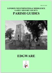
Edgware
This booklet contains a list of the main records of interest to the genealogical researcher for the area based on the ancient parish of Edgware, which includes the districts of Broadfields, Edgwarebury, The Hale and parts of Elstree village. This area was in the county of Middlesex but is now in the London Borough of Barnet. Apart from the vital records of the various religious denominations, examples…
Supplied by: London Westminster & Middlesex Family History Society (LWMFHS) Product Ref: LWM-PG035
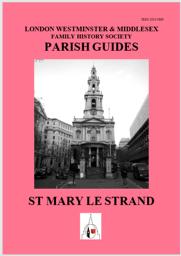
St Mary le Strand
This booklet contains a list of the main records of interest to the genealogical researcher for the area based on the ancient parish of St Mary le Strand plus the Precinct of the Savoy. St Mary le Strand is now part of the London Borough of Westminster. Apart from the vital records of the various religious denominations, examples of subjects covered in this booklet are the plethora of institutions…
Supplied by: London Westminster & Middlesex Family History Society (LWMFHS) Product Ref: LWM-PG039
Kent FHS CD 21 Parish Registers Volume 7 Free P&P
The records on the CD have been transcribed by members of Kent Family History Society and are in pdf format. A program such as Adobe Acrobat Reader DC is required. If you have a query about any of our publications please e-mail [email protected] The following indexes are included on the CD Allington Bap. 1630-1876 Mar. 1640-1877 Bns. 1777-1919 Bur. 1633-1876 Appledore Bap. 1700-1812 Mar. 1700-1837…
Supplied by: Kent Family History Society Product Ref: KFS-CD 21
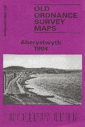
Aberystwyth Town Plan (1904)
Sheet 6.09 - This detailed map covers most of this university town, and features include the Cambrian station, engine sheds, Vale of Rheidol station, Pont Aberystwyth, University College (in town, not today's buildings), St Michael's church, Royal Pier Pavilion, castle ruins, Marine Terrace, Workhouse, Queen's Hotel, old quarries, Cliff Railway. Constitution Hill is at the top of the map. Extracts…
Supplied by: Cardiganshire Family History Society, Cymdeithas Hanes Teuluoedd Ceredigion Product Ref: CGN-W13
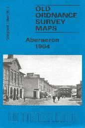
Aberaeron Town Plan (1904)
Sheet 18.12 - This detailed map covers the small Cardiganshire town of Aberaeron (or Aberayron) which in 1904 was in the twilight years of its prosperity as a port. The town spans the parishes of Llandewi Aberarth Lower and Henfynyw Lower. The town is shown here in detail, including individual houses, and features include the Workhouse, breakwaters, Pant-teg, Pen y Gloyn, quarries, Goetre etc. On the…
Supplied by: Cardiganshire Family History Society, Cymdeithas Hanes Teuluoedd Ceredigion Product Ref: CGN-W19
Hatfield St Lawrence
First Published December 2013 Third Edition August 2024 amended December 2024 amended January 2025 Contents: Introduction Hatfield – a short history Hatfield St Lawrence Baptisms 1567 to 1939 Dade Registers 1777 to 1812 Marriages 1566 to 1940 Burials 1567 to 1943 Monumental Inscriptions War Memorials Hatfield Hatfield Cemetery 1886 to 2024 Old Workhouse Pigot’s Directory 1828/29 White’s Directory…
Supplied by: Doncaster and District Family History Society Product Ref: DON-1085
Rotherham All Saints
Contents Rotherham All Saints Baptisms 1813 to 1849 Marriages 1754 to 1837 Burials 1541 to 1881 Rotherham Workhouse Births 1848 to 1879 & 1912 to 1917 The information was originally compiled by the Rotherham Family History Society
Supplied by: Doncaster and District Family History Society Product Ref: DON-roth509
Luton Parish CD
V 3: Transcripts of Parish Registers 1602-1812 and the 1851 Census Index, with searchable indexes to BAPTISMS: St Mary (1602-1852), Baptist (1785-1837), Primitive Methodist (1843-1852), Methodist (1803-1837) & Wesleyan (1839-1852), MARRIAGES: St Mary (1602-1812 & 1813-1837), Quakers (1802-1834 & 1853-1875), Luton Reg.District (1837-1885), Holy Trinity (1868-1885), Baptist (1841-1878), Ceylon…
Supplied by: Bedfordshire Family History Society Product Ref: BDF-PRCD56
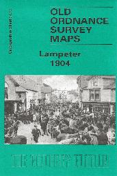
Lampeter Town Plan (1904)
Sheet 34.13 - This detailed map covers the small town of Lampeter, which in 1820 had been chosen as the site of St David's College, today part of the University of Wales. Lampeter was also a significant agricultural centre, and a collecting point for drovers. In 1901, it had a population of 1,722. Our map shows the town centre in some detail, and other features include the railway station, Workhouse,…
Supplied by: Cardiganshire Family History Society, Cymdeithas Hanes Teuluoedd Ceredigion Product Ref: CGN-W14
Thorne St Nicholas
First Published December 2013 Revised June 2015 2nd Revision October 2017 3rd Revision April 2019 4th Revision July 2020 Information includes: Thorne St Nicholas Church Baptisms 1565 to 1936 Burials 1565 to 1956 Marriages 1565 to 1940 Monumental Inscriptions and War Memorials Thorne Congregational Baptisms 1805 to 1931 Unitarian Baptisms 1817 to 1837 Unitarian Burials 1813 to 1837 Wesleyan Baptisms…
Supplied by: Doncaster and District Family History Society Product Ref: DON-1082
Making Ends Meet
Charity organisations official poor relief, the workhouse, bankruptcy, insolvency, poor shops.
Supplied by: Hampshire Genealogical Society Product Ref: HAM-34010
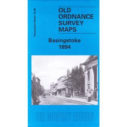
Basingstoke 1894
The map shows Basingstoke and includes the canal, the railway, the workhouse and the areas of South View, Eastrop, the Common and Ruckstalls Hill. The On the back the history of the town is by Alan Godfrey. From the 1899 Kelly’s Directory there are lists of the Corporation, local railway stations, the schools and details of Basingstoke Union as well as some private residents.
Supplied by: Hampshire Genealogical Society Product Ref: HAM-13966703

One Monday in November - and Beyond
The story of the Selborne and Headley Workhouse Riots during the Swing Riots of 1830 - and their aftermath - illustrations, maps biographies. John Owen Smith [See also JOS-01-X; JOS-30-3; JOS-36-2] Supplied by John Owen Smith
Supplied by: John Owen Smith - Publisher Product Ref: JOS-33-8
Forden Montgomeryshire Memorial Inscriptions (MI/37)
Parish Church, Chapels and Forden Workhouse
Supplied by: Montgomeryshire Genealogical Society, Cymdeithas Achyddol Maldwyn Product Ref: MGY-MI/37
Forden Montgomeryshire - Parish Registers 1813-1849+ (PR/120)
Baptisms 1813-1841 (Workhouse 1813-1863) and Burials 1813-1849
Supplied by: Montgomeryshire Genealogical Society, Cymdeithas Achyddol Maldwyn Product Ref: MGY-PR/120