Product Search
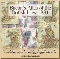
Bacon's Atlas of the British Isles 1881
This virtual DVD resource covers England, Scotland, Wales and Ireland with over 100 high-resolution county and street maps. Includes an index of place names, population and statistical information from the 1871 and 1881 census.
Supplied by: S&N Genealogy Supplies Product Ref: SNG-6768
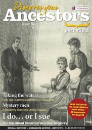
Discover Your Ancestors Periodical - Issue 88 (August 2020)
Keep up to date with the genealogy world and learn more about your hobby with the critically acclaimed Discover Your Ancestors online periodical. Whether you are just starting out or have reached a brick wall in your research, this will help and inspire you on your family history journey. Receive guidance from experts, tips on the best sources for records, explore connections around the world and bring…
Supplied by: S&N Genealogy Supplies Product Ref: SNG-7004
The Reminiscences of Henry Spooner
A nostalgic look back at the Barnsley of the 1910-1940 period, most of which has been swept away by the re-developments of the 1970s. In his youth, the author was apprenticed to Billington's Chemist in Eldon Street, and he is able to paint a vivid word picture of the life of an era now long lost.
Supplied by: Barnsley Family History Society Product Ref: BAR-B0-03
Stainbrough and Wortley - 1851 (HO 107/ 2333)
**All that part of the Township of Wortley, including the whole of the Village of Wortley, Wortley Hall, Cottage at the bottom of High Wood, Park House, Westwood Lodge, Stors House, Bromley, Howbrook, Ruggon, Townend House, Booth Wood Lodge, Rotherham Gates Lodge, the Chemical Works at Huscars, the Wortley Station, and Cottages near thereto, the Chemical Works, Old Mill, Cottages at Wortley Station,…
Supplied by: Barnsley Family History Society Product Ref: BAR-CEN-20
Barnsley Town Maps
Includes a comprehensive index (with map references) to streets, churches, public houses, foundries, etc. **Surveyed in 1888 covering the areas between: Gawber-Greenfoot; Pogmoor-Eldon Street; Dodworth Road-Spring Gardens; Keresforth-Worsborough Common; Pontefract Road-Grange Lane; Mount Vernon-Ardsley Cemetary.** Covering an area of 38.4 acres in 16 maps. A combined map is also included.
Supplied by: Barnsley Family History Society Product Ref: BAR-MA-CD01
Barnsley - 1851 (HO 107/ 2332) (Surnames S-Y)
Column headings: Surname; Forename; Relationship to head of household; Marital status; Age; Occupation; County of birth; Place of birth; Folio number; Page number. Surnames in Index: SABEN; SACK; SADLER; SALMON; SANDERSON; SANDIFOOT; SANDIFORTH; SANDISON; SAVAGE; SAVILE; SAVILLE; SAW; SCAFF; SCALES; SCALLY; SCANLON; SCARFE; SCARGIL; SCARGILL; SCATCHERD; SCATHARD; SCHARF; SCHOFIELD; SCHOLEY; SCOTT;…
Supplied by: Barnsley Family History Society Product Ref: BAR-CEN-18
War Memorials And War Graves Vol 10 - Amersham, Chesham area
Covering: Amersham, Ashley Green, Chenies, Chesham, Cholesbury, Chesham, Chesham Bois, Coleshill, Hawridge, Latimer, Ley hill, Penn, Penn Street, St Leonards all memorials
Supplied by: The Mclaughlin Guides and Buckinghamshire related books and historic maps Product Ref: BGS-B20
WENDOVER 1792 A3 Map with all landowners marked
hand drawn street map with every house and resident, landowner marked
Supplied by: The Mclaughlin Guides and Buckinghamshire related books and historic maps Product Ref: BGS-B127
Aberystwth 1834 A3 Map
detailed coloured street map by John Wood [sent in tube]
Supplied by: The Mclaughlin Guides and Buckinghamshire related books and historic maps Product Ref: BGS-M1
Bangor 1834 A3 Map
detailed coloured street map [sent in tube]
Supplied by: The Mclaughlin Guides and Buckinghamshire related books and historic maps Product Ref: BGS-M2
Bath 1837 A3 Map
detailed coloured street map by Thomas Moule [sent in tube]
Supplied by: The Mclaughlin Guides and Buckinghamshire related books and historic maps Product Ref: BGS-M3
Bedford 1801 A3 Map
detailed coloured street map [sent in tube]
Supplied by: The Mclaughlin Guides and Buckinghamshire related books and historic maps Product Ref: BGS-M4
Belfast 1851 A3 Map
detailed coloured street map [sent in tube]
Supplied by: The Mclaughlin Guides and Buckinghamshire related books and historic maps Product Ref: BGS-M5
Birmingham 1866 A3 Map
detailed coloured street map [sent in tube]
Supplied by: The Mclaughlin Guides and Buckinghamshire related books and historic maps Product Ref: BGS-M6
Boston 1837 A3 Map
detailed coloured street map [sent in tube]
Supplied by: The Mclaughlin Guides and Buckinghamshire related books and historic maps Product Ref: BGS-M7
Bradford 1851 A3 Map
detailed coloured street map [sent in tube]
Supplied by: The Mclaughlin Guides and Buckinghamshire related books and historic maps Product Ref: BGS-M8
Brighton 1851 A3 Map
detailed coloured street map [sent in tube]
Supplied by: The Mclaughlin Guides and Buckinghamshire related books and historic maps Product Ref: BGS-M9
Bristol & Clifton 1851 A3 Map
detailed coloured street map [sent in tube]
Supplied by: The Mclaughlin Guides and Buckinghamshire related books and historic maps Product Ref: BGS-M10
Bristol 1866 A3 Map
detailed coloured street map [sent in tube]
Supplied by: The Mclaughlin Guides and Buckinghamshire related books and historic maps Product Ref: BGS-M11
Caernarvon 1834 A3 Map
detailed coloured street map [sent in tube]
Supplied by: The Mclaughlin Guides and Buckinghamshire related books and historic maps Product Ref: BGS-M12
Cambridge 1801 A3 Map
detailed coloured street map [sent in tube]
Supplied by: The Mclaughlin Guides and Buckinghamshire related books and historic maps Product Ref: BGS-M13
Cambridge 1837 A3 Map
detailed coloured street map [sent in tube]
Supplied by: The Mclaughlin Guides and Buckinghamshire related books and historic maps Product Ref: BGS-M14
Canterbury 1801 A3 Map
detailed coloured street map [sent in tube]
Supplied by: The Mclaughlin Guides and Buckinghamshire related books and historic maps Product Ref: BGS-M15
Cardigan 1834 A3 Map
detailed coloured street map [sent in tube]
Supplied by: The Mclaughlin Guides and Buckinghamshire related books and historic maps Product Ref: BGS-M16
Carlisle 1801 A3 Map
detailed coloured street map [sent in tube]
Supplied by: The Mclaughlin Guides and Buckinghamshire related books and historic maps Product Ref: BGS-M17