Product Search
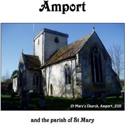
Amport (Village Booklet 82)
The village of Amport and the Parish of St Mary
Supplied by: Hampshire Genealogical Society Product Ref: HAM-16082

An Historic Map of Wotton-under–Edge
This A4 size coloured map is based on the 1882 Ordnance Survey map of the town at 25 inches to the mile. The map has been annotated with information on some of the historic buildings, people and facts. As well as being of interest in itself it makes an ideal gift when visiting relatives and friends abroad.
Supplied by: Wotton-under-Edge Historical Society Product Ref: WUE-120
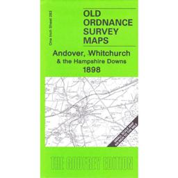
Andover & Whitchurch 1898
This map covers the area from Andover and Whitchurch as well as Buttermere and Highclere. On the reverse is a larger scale map of the Weyhill. The history of the area is by Tony Painter.
Supplied by: Hampshire Genealogical Society Product Ref: HAM-13966782
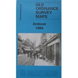
Andover 1894
As well as the map there is a local history written by Alan Godfrey and details of businesses, services and private residents recorded in the Kelly's Directory for Hampshire, 1899.
Supplied by: Hampshire Genealogical Society Product Ref: HAM-13966811
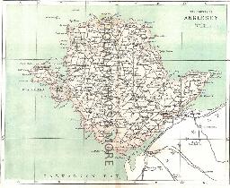
ANGLESEY - 1883
A QUALITY A3 SIZE COLOUR REPRODUCTION FROM AN 1883 ATLAS. LASER PRINTER ON GOOD QUALITY CARTRIDGE PAPER. SENT FOLDED IN A PLASTIC DISPLAY SLEEVE IN A STIFF CARD ENVELOPE AT THE LARGE LETTER RATE. SCALES VARY
Supplied by: Quality Maps and More Product Ref: QMM-MP410
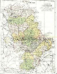
ANTRIM 1882
A QUALITY A3 SIZE COLOUR REPRODUCTION FROM PHILIP'S 1882 ATLAS. LASER PRINTER ON GOOD QUALITY CARTRIDGE PAPER. SENT FOLDED IN A PLASTIC DISPLAY SLEEVE IN A STIFF CARD ENVELOPE AT THE LARGE LETTER RATE. SCALES VARY [WATERMARKS WILL NOT SHOW ON PURCHASES]
Supplied by: Quality Maps and More Product Ref: QMM-MP201
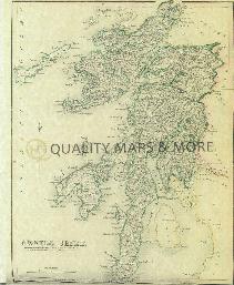
ARGYLL 1845
A QUALITY A3 SIZE COLOUR REPRODUCTION FROM THE NEW STATISTICAL ACCOUNT OF SCOTLAND 1845. MOST MAPS HAVE THE PARISHES OUTLINED LASER PRINTER ON GOOD QUALITY CARTRIDGE PAPER. SENT FOLDED IN A PLASTIC DISPLAY SLEEVE IN A STIFF CARD ENVELOPE AT THE LARGE LETTER RATE. SCALES VARY [WATERMARKS WILL NOT SHOW ON PURCHASES]
Supplied by: Quality Maps and More Product Ref: QMM-MP302
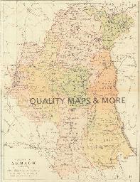
ARMAGH 1882
A QUALITY A3 SIZE COLOUR REPRODUCTION FROM PHILIP'S 1882 ATLAS. LASER PRINTER ON GOOD QUALITY CARTRIDGE PAPER. SENT FOLDED IN A PLASTIC DISPLAY SLEEVE IN A STIFF CARD ENVELOPE AT THE LARGE LETTER RATE. SCALES VARY [WATERMARKS WILL NOT SHOW ON PURCHASES]
Supplied by: Quality Maps and More Product Ref: QMM-MP202
Atlas of London circa 1908
By J & A Catlyn, published by Cyrene Publications (2003). 20 coloured maps of Central London, with searchable Index to over 7000 streets computer-linked to the maps. An Index to 1000 places of interest in London and 16 maps of the Environs of London. Included is a small eight-page booklet advising on how to make the best use of this CD.
Supplied by: West Surrey Family History Society Product Ref: WSY-CDA
Attercliffe 1903
Map of populous industrial area of Lower Don Valley in north east of Sheffield.
Supplied by: Sheffield & District Family History Society Product Ref: SHE-G70101
AYR 1845
A QUALITY A3 SIZE COLOUR REPRODUCTION FROM THE NEW STATISTICAL ACCOUNT OF SCOTLAND 1845. MOST MAPS HAVE THE PARISHES OUTLINED LASER PRINTER ON GOOD QUALITY CARTRIDGE PAPER. SENT FOLDED IN A PLASTIC DISPLAY SLEEVE IN A STIFF CARD ENVELOPE AT THE LARGE LETTER RATE. SCALES VARY [WATERMARKS WILL NOT SHOW ON PURCHASES]
Supplied by: Quality Maps and More Product Ref: QMM-MP303
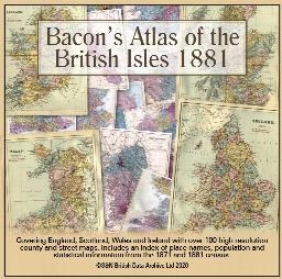
Bacon's Atlas of the British Isles 1881
This virtual DVD resource covers England, Scotland, Wales and Ireland with over 100 high-resolution county and street maps. Includes an index of place names, population and statistical information from the 1871 and 1881 census.
Supplied by: S&N Genealogy Supplies Product Ref: SNG-6768
BANFF 1845
A QUALITY A3 SIZE COLOUR REPRODUCTION FROM THE NEW STATISTICAL ACCOUNT OF SCOTLAND 1845. MOST MAPS HAVE THE PARISHES OUTLINED LASER PRINTER ON GOOD QUALITY CARTRIDGE PAPER. SENT FOLDED IN A PLASTIC DISPLAY SLEEVE IN A STIFF CARD ENVELOPE AT THE LARGE LETTER RATE. SCALES VARY [WATERMARKS WILL NOT SHOW ON PURCHASES]
Supplied by: Quality Maps and More Product Ref: QMM-MP304
Bangor 1834 A3 Map
detailed coloured street map [sent in tube]
Supplied by: The Mclaughlin Guides and Buckinghamshire related books and historic maps Product Ref: BGS-M2
Bartholomew's Handy Reference Atlas of London & Suburbs 1930 on CD
Bartholomew's Handy Reference Atlas of London and Suburbs Walk the streets of London as they were in 1930. \*Digitally enchanced images of the original text \*Includes full colour maps \*Searchable by whole or part name \*Bookmarked by major headings \*Fully printable
Supplied by: S&N Genealogy Supplies Product Ref: SNG-3588
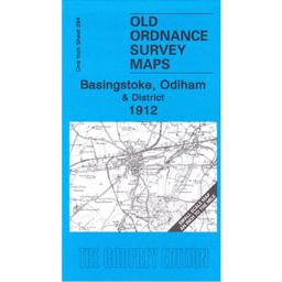
Basingstoke & Odiham 1912
This map covers the area from Andover and Whitchurch as well as Buttermere and Highclere. On the reverse is a larger scale map of the Weyhill. The history of the area is by Tony Painter.
Supplied by: Hampshire Genealogical Society Product Ref: HAM-13966786
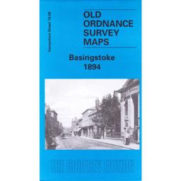
Basingstoke 1894
The map shows Basingstoke and includes the canal, the railway, the workhouse and the areas of South View, Eastrop, the Common and Ruckstalls Hill. The On the back the history of the town is by Alan Godfrey. From the 1899 Kelly’s Directory there are lists of the Corporation, local railway stations, the schools and details of Basingstoke Union as well as some private residents.
Supplied by: Hampshire Genealogical Society Product Ref: HAM-13966703
Bath 1837 A3 Map
detailed coloured street map by Thomas Moule [sent in tube]
Supplied by: The Mclaughlin Guides and Buckinghamshire related books and historic maps Product Ref: BGS-M3
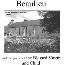
Beaulieu (Village Booklet 67)
The village of Beaulieu and the parish of the Blessed Virgin and Child.
Supplied by: Hampshire Genealogical Society Product Ref: HAM-16067
Bedford 1801 A3 Map
detailed coloured street map [sent in tube]
Supplied by: The Mclaughlin Guides and Buckinghamshire related books and historic maps Product Ref: BGS-M4
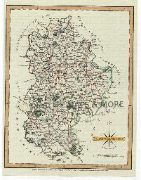
BEDFORDSHIRE 1787
A QUALITY A3 SIZE COLOUR REPRODUCTION FROM JOHN CARY'S 1787 ATLAS WITH DETAILS OF THE COUNTY OVERLEAF. LASER PRINTER ON GOOD QUALITY CARTRIDGE PAPER. SENT FOLDED IN A PLASTIC DISPLAY SLEEVE IN A STIFF CARD ENVELOPE AT THE LARGE LETTER RATE. SCALES VARY [WATERMARKS WILL NOT SHOW ON PURCHASES]
Supplied by: Quality Maps and More Product Ref: QMM-MP101
Bedfordshire 1837 A3 County Map
detailed coloured county map [sent in tube]
Supplied by: The Mclaughlin Guides and Buckinghamshire related books and historic maps Product Ref: BGS-M61
Belfast 1851 A3 Map
detailed coloured street map [sent in tube]
Supplied by: The Mclaughlin Guides and Buckinghamshire related books and historic maps Product Ref: BGS-M5
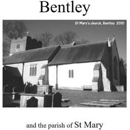
Bentley (Village Booklet 72)
The village of Bentley and the parish of St Mary
Supplied by: Hampshire Genealogical Society Product Ref: HAM-16072
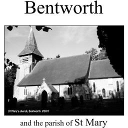
Bentworth (Village Booklet 44)
The village of Bentworth and the parish of St. Mary.
Supplied by: Hampshire Genealogical Society Product Ref: HAM-16044