Product Search
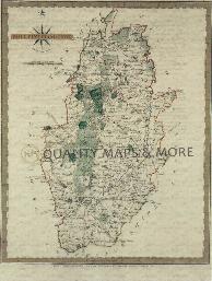
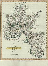
NOTTINGHAMSHIRE 1787
A QUALITY A3 SIZE COLOUR REPRODUCTION FROM JOHN CARY'S 1787 ATLAS WITH DETAILS OF THE COUNTY OVERLEAF. LASER PRINTER ON GOOD QUALITY CARTRIDGE PAPER. SENT FOLDED IN A PLASTIC DISPLAY SLEEVE IN A STIFF CARD ENVELOPE AT THE LARGE LETTER RATE. SCALES VARY...
Supplied by: Quality Maps and More Product Ref: QMM-MP127
Nottinghamshire 1837 A3 County Map
detailed coloured map [sent in tube]...
Supplied by: The Mclaughlin Guides and Buckinghamshire related books and historic maps Product Ref: BGS-M88
Old Basing (Village Booklet 13)
The village of Old Basing and the parish of St. Mary...
Supplied by: Hampshire Genealogical Society Product Ref: HAM-16013
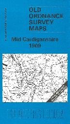
Old Ordnance Survey one-inch Map. - Mid Cardiganshire (1909)
Sheet 178, showing the area around Llanrhystud, Llanilar, Strata Florida and Devil's Bridge. On the reverse is a large scale plan of Llanrhystud in 1904, and an essay on the history of the area by Alan Leather....
Supplied by: Cardiganshire Family History Society, Cymdeithas Hanes Teuluoedd Ceredigion Product Ref: CGN-W10
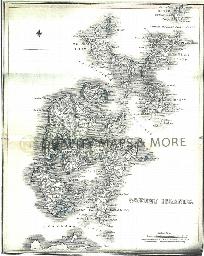
ORKNEY Islands 1845
A QUALITY A3 SIZE COLOUR REPRODUCTION FROM THE NEW STATISTICAL ACCOUNT OF SCOTLAND 1845. MOST MAPS HAVE THE PARISHES OUTLINED LASER PRINTER ON GOOD QUALITY CARTRIDGE PAPER. SENT FOLDED IN A PLASTIC DISPLAY SLEEVE IN A STIFF CARD ENVELOPE AT THE LARGE LETTER RATE. SCALES VARY [WATERMARKS WILL NOT SHOW ON PURCHASES]...
Supplied by: Quality Maps and More Product Ref: QMM-MP320
Otterbourne (Village Booklet 109)
The Village of Otterbourne and the Parish of St Matthew...
Supplied by: Hampshire Genealogical Society Product Ref: HAM-16109
Over Wallop (Village Booklet 97)
The Village of Over Wallop and the Parish of St Peter...
Supplied by: Hampshire Genealogical Society Product Ref: HAM-16097
Ovington (Village Booklet 12)
The village of Ovington and the parish of St. Peter...
Supplied by: Hampshire Genealogical Society Product Ref: HAM-16012
Owslebury (Village Booklet 36)
The village of Owslebury and the parish of St. Andrew...
Supplied by: Hampshire Genealogical Society Product Ref: HAM-16036
Oxford 1801 A3 map
detailed coloured street map [sent in tube]...
Supplied by: The Mclaughlin Guides and Buckinghamshire related books and historic maps Product Ref: BGS-M48
Oxford 1837 A3 Map
A3 size coloured map with vignettes will be [sent in a tube]...
Supplied by: The Mclaughlin Guides and Buckinghamshire related books and historic maps Product Ref: BGS-M49
Oxford c.1890 Map CD
Stepping Stones publication Oxford c.1890 Map CD...
Supplied by: S&N Genealogy Supplies Product Ref: SNG-5132
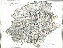
OXFORDSHIRE 1787
A QUALITY A3 SIZE COLOUR REPRODUCTION FROM JOHN CARY'S 1787 ATLAS WITH DETAILS OF THE COUNTY OVERLEAF. LASER PRINTER ON GOOD QUALITY CARTRIDGE PAPER. SENT FOLDED IN A PLASTIC DISPLAY SLEEVE IN A STIFF CARD ENVELOPE AT THE LARGE LETTER RATE. SCALES VARY...
Supplied by: Quality Maps and More Product Ref: QMM-MP128
Oxfordshire 1837 A3 County Map
detailed coloured map [sent in tube]...
Supplied by: The Mclaughlin Guides and Buckinghamshire related books and historic maps Product Ref: BGS-M89
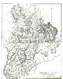
PEEBLES 1845
A QUALITY A3 SIZE COLOUR REPRODUCTION FROM THE NEW STATISTICAL ACCOUNT OF SCOTLAND 1845. MOST MAPS HAVE THE PARISHES OUTLINED LASER PRINTER ON GOOD QUALITY CARTRIDGE PAPER. SENT FOLDED IN A PLASTIC DISPLAY SLEEVE IN A STIFF CARD ENVELOPE AT THE LARGE LETTER RATE. SCALES VARY [WATERMARKS WILL NOT SHOW ON PURCHASES]...
Supplied by: Quality Maps and More Product Ref: QMM-MP321
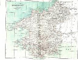
PEMBROKE 1883
A QUALITY A3 SIZE COLOUR REPRODUCTION FROM AN 1883 ATLAS. LASER PRINTER ON GOOD QUALITY CARTRIDGE PAPER. SENT FOLDED IN A PLASTIC DISPLAY SLEEVE IN A STIFF CARD ENVELOPE AT THE LARGE LETTER RATE. SCALES VARY...
Supplied by: Quality Maps and More Product Ref: QMM-MP420
Penistone and Thurlstone 1903
Map of market town to north west of Sheffield....
Supplied by: Sheffield & District Family History Society Product Ref: SHE-G70113
PERTH & CLACKMANNAN 1845
A QUALITY A3 SIZE COLOUR REPRODUCTION FROM THE NEW STATISTICAL ACCOUNT OF SCOTLAND 1845. MOST MAPS HAVE THE PARISHES OUTLINED LASER PRINTER ON GOOD QUALITY CARTRIDGE PAPER. SENT FOLDED IN A PLASTIC DISPLAY SLEEVE IN A STIFF CARD ENVELOPE AT THE LARGE LETTER RATE. SCALES VARY [WATERMARKS WILL NOT SHOW ON PURCHASES]...
Supplied by: Quality Maps and More Product Ref: QMM-MP322
Perth 1851 A3 Map
detailed coloured street map [sent in tube]...
Supplied by: The Mclaughlin Guides and Buckinghamshire related books and historic maps Product Ref: BGS-M50
Place Names of the North Riding of Yorkshire
19th Century Gazetteer of the North Riding of Yorkshire by John P Perkins. Available as a print out....
Supplied by: Cleveland, North Yorkshire & South Durham Family History Society Product Ref: CYD-POP1001A
Place Names of the North Riding of Yorkshire
19TH Century Gazetteer of the North Riding of Yorkshire by John P Perkins...
Supplied by: Cleveland, North Yorkshire & South Durham Family History Society Product Ref: CYD-OP1001A
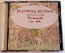
Plymouth c.1890 Map CD
Stepping Stones publication Plymouth c.1890 Map CD...
Supplied by: S&N Genealogy Supplies Product Ref: SNG-5134
PM001 Wiltshire Parishes Map
Map of Wiltshire & Contiguous Parishes with index and notes. Single A3 sheet folded to A4...
Supplied by: Wiltshire Family History Society Product Ref: WIL-PM001
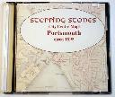
Portsmouth c.1895 Map CD
Stepping Stones publication Portsmouth c.1895 Map CD...
Supplied by: S&N Genealogy Supplies Product Ref: SNG-5136
Preston 1851 A3 Map
detailed coloured street map [sent in tube]...
Supplied by: The Mclaughlin Guides and Buckinghamshire related books and historic maps Product Ref: BGS-M52