Product Search
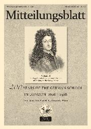
200 years of the German School in London 1708-1908
"200 Jahre deutscher Schule in London 1708-1908". A history of the German School attached to St Mary in the Savoy, London, published in 1908 for the bi-centenary of the school. Translated by Amanda Price. Occasional issue No 2 (2016)
Supplied by: Anglo-German Family History Society Product Ref: ANG-O2
CD30 Ancient Parishes in the GUILDFORD District - Transcriptions and indexes
The Parish Register Transcriptions and Indexes on this CD have been brought together from other publications produced by West Surrey FHS. They are, therefore, of varying quality but all are fully legible. There is no overall Index to the names within the records. Each Parish is individually indexed and usually each register, Baptism, Marriage or Burial has been indexed separately. In some cases there…
Supplied by: West Surrey Family History Society Product Ref: WSY-CD30
Mancetter St Peter Baptisms + Atherstone and Hartshill
Baptisms: Mancetter 1813-61; Hartshill Holy Trinity 1848-61; Atherstone St Mary 1825-61; transcriptions
Supplied by: Nuneaton & North Warwickshire Family History Society (NNWFHS) Product Ref: NUN-0033
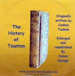
THE HISTORY OF TAUNTON by Joshua Toulmin
First published in the early 1790's, updated and republished in 1822 by James Davage, this is still probably one of the most useful and important works written about the county town of Somerset. The book contains in great detail all of the main historical events that have taken place or connected to Taunton . There are also transcripts of the monumental transcriptions at St Mary's church, St. James…
Supplied by: WestCountryBooks Product Ref: TBS-007
CASTLES & ABBEYS OF YORKSHIRE
A history and description of over forty of the most interesting ruins, most of which were visited by the author, during the two years previous to his writing this work in 1855. Includes: Barden Tower, Bolton Priory, Bolton Castle, Bowes Castle, Bridlington Priory, Byland Abbey, Cawood Castle, Conisborough Castle, Coverham Abbey, Craike Castle, Easby Abbey, Eggleston Abbey, Fountains Abbey, Guisborough…
Supplied by: Yorkshire Ancestors Product Ref: YAN-GW097
Calderdale FHS MIs - Set 1
MIs from 38 graveyards, fully indexed and searchable. Graveyards covered are Blackley Baptist/Booth URC/Boothtown All Souls/ Boulderclough Meths. Sowerby/Bradshaw St. John/ Claremount St. Thomas/Copley St Stephen/Cragg Vale Meths./Halifax Quakers/Hebden Bridge Cross Lane Meths/ Hebden Bridge St James/Holywell Green URC/Luddenden Foot Meths./Luddenden Foot St. Mary/Midgley Providence Meths/ Moor End…
Supplied by: Calderdale Family History Society, (incorporating Halifax & District) Product Ref: CAL-1MIC14
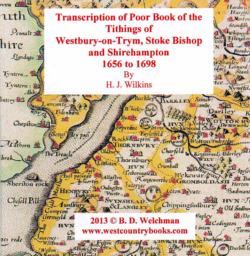
TRANSCRIPTION OF POOR BOOK OF THE TITHINGS OF WESTBURY-ON-TRYM, STOKE BISHOP AND SHIREHAMPTON 1656 TO 1698 by H. J. Wilkins
This book deals with an unsettled period of English History, for it runs from 1656 to 1698 which is a period that embraces part of the Protectorate (1653 to 1659), the restored Commonwealth (1659), the reign of Charles II (1660 to 1685) the reign of James II (1685 to 1688) and William and Mary to 1689. As with all “Poor Books” it deals with the income and disbursement to the poor. There are many hundreds…
Supplied by: WestCountryBooks Product Ref: TBS-13955565
Yorkshire - Ainderby Steeple St Helen ,Great Fencote St Andrew, Great Langton St Wilfred, Kirby Fleetham and Scruton St Radegund. Area Monumental Inscriptions
This CD contains monumental inscriptions in PDF format for Ainderby Steeple St Helen, Great Fencote St Andrew, Great Langton St Wilfred,Kirby Fleetham St Mary and Scruton St Radegund.
Supplied by: Cleveland, North Yorkshire & South Durham Family History Society Product Ref: CYD-1
Yorkshire - Hawes, Askrigg ,Gayle, Hardraw, Bainbridge and Carperby Churches and Burial grounds Monumental Inscriptions
This CD contains monumental inscriptions in PDF format for Askrigg St. Oswald, Gayle Sandemanians Burial Ground, Hardraw St Mary and St John, Hawes St Margaret and Quaker Burial Ground, Bainbridge and Carperby Quaker Burial Ground
Supplied by: Cleveland, North Yorkshire & South Durham Family History Society Product Ref: CYD-37
Durham - High Coniscliffe Cemetery, Girsby All Saints, High Coniscliffe St Edwin,Ingleton St John, Middleton One Row St George, Piercebridge St Maryand Ingleton Area Monumental Inscriptions
This CD contains monumental inscriptions in PDF format for Coniscliffe Cemetery, Girsby All Saints, High Coniscliffe St Edwin,Ingleton St John, Middleton One Row St George, Piercebridge St Mary
Supplied by: Cleveland, North Yorkshire & South Durham Family History Society Product Ref: CYD-39
Durham - Thornley, Trimdon ,Deaf Hill, Langdale ,Kelloe,Quarrington ,Wingate Churches, Chapels, Cemeteries and Churchyards Monumental Inscriptions
This CD contains monumental inscriptions in PDF format for Deaf Hill cum Langdale St Paul, Kelloe St Helen & Cemetery, Quarrington Hill Chapel, Thornley St Bartholomew, Trimdon St Mary & Cemetery, Wingate Churchyard
Supplied by: Cleveland, North Yorkshire & South Durham Family History Society Product Ref: CYD-64
Yorkshire - Patrick Brompton and Finghall Area Monumental Inscriptions
This CD contains monumental inscriptions in PDF format for Crakehall St Gregory, Finghall St Andrew, Hornby St Mary, Patrick Brompton St Patrick, Thornton Steward St Oswald
Supplied by: Cleveland, North Yorkshire & South Durham Family History Society Product Ref: CYD-79
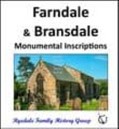
Farndale and Bransdale - Monumental Inscriptions
Includes the details of every memorial in the Church and Churchyard of St. Mary, Farndale and St. Nicholas, Bransdale The book is text only and does not include photographs. The CD and DOWNLOAD both include a photograph of every monument.
Supplied by: Ryedale Family History Group Product Ref: RFH-MI-bk001

Farndale and Bransdale - Monumental Inscriptions
Includes the details of every memorial in the Church and Churchyard of St. Mary, Farndale and St. Nicholas, Bransdale The book is text only and does not include photographs. The CD and DOWNLOAD both include a photograph of every monument.
Supplied by: Ryedale Family History Group Product Ref: RFH-MI-cd001

Farndale and Bransdale - Monumental Inscriptions
Includes the details of every memorial in the Church and Churchyard of St. Mary, Farndale and St. Nicholas, Bransdale The book is text only and does not include photographs. The CD and DOWNLOAD both include a photograph of every monument.
Supplied by: Ryedale Family History Group Product Ref: RFH-MI-d001

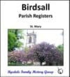
Birdsall - Parish Registers (Baptisms, Marriages & Burials)
A transcript of the Parish Registers of St. Mary, Birdsall Baptisms: 1790 - 1886 Marriages: 1756 - 1887 Burials: 1813 - 1889
Supplied by: Ryedale Family History Group Product Ref: RFH-PR-cd005
Birdsall - Parish Registers (Baptisms, Marriages & Burials)
A transcript of the Parish Registers of St. Mary, Birdsall Baptisms: 1790 - 1886 Marriages: 1756 - 1887 Burials: 1813 - 1889
Supplied by: Ryedale Family History Group Product Ref: RFH-PR-d005
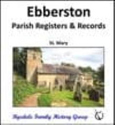
Ebberston - Parish Registers and Records (Baptisms, Marriages & Burials)
A transcript of the Parish Registers of St. Mary, Ebberston Baptisms: 1680 - 1880 Marriages: 1680 - 1880 Burials: 1678 - 1980 History of Ebberston Terriers Notes
Supplied by: Ryedale Family History Group Product Ref: RFH-PR-cd008
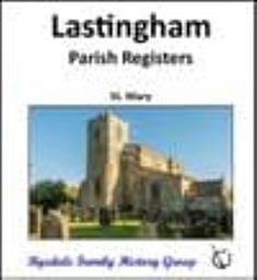
Lastingham - Parish Registers (Baptisms, Marriages & Burials)
A transcript of the Parish Registers of St. Mary, Lastingham Baptisms: 1601 - 1907 Marriages: 1559 - 1920 Burials: 1559 - 1912
Supplied by: Ryedale Family History Group Product Ref: RFH-PR-cd015

Lastingham - Parish Registers (Baptisms, Marriages & Burials)
A transcript of the Parish Registers of St. Mary, Lastingham Baptisms: 1601 - 1907 Marriages: 1559 - 1920 Burials: 1559 - 1912
Supplied by: Ryedale Family History Group Product Ref: RFH-PR-d015

Ebberston - Parish Registers and Records (Baptisms, Marriages & Burials)
A transcript of the Parish Registers of St. Mary, Ebberston Baptisms: 1680 - 1880 Marriages: 1680 - 1880 Burials: 1678 - 1980 History of Ebberston Terriers Notes
Supplied by: Ryedale Family History Group Product Ref: RFH-PR-d008
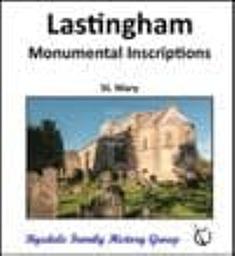
Lastingham - Monumental Inscriptions
Includes the details of every memorial in the Church and Churchyard of St. Mary, Lastingham As recorded c1990, by Barbara Aconley, and reproduced here with her permission and our thanks. There are no photos in this publication, however, if a photo of a particular monument is required, our volunteers can help.
Supplied by: Ryedale Family History Group Product Ref: RFH-MI-cd020

Lastingham - Monumental Inscriptions
Includes the details of every memorial in the Church and Churchyard of St. Mary, Lastingham As recorded c1990, by Barbara Aconley, and reproduced here with her permission and our thanks. There are no photos in this publication, however, if a photo of a particular monument is required, our volunteers can help.
Supplied by: Ryedale Family History Group Product Ref: RFH-MI-d020

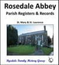
Rosedale Abbey - Parish Registers and Records (Baptisms, Marriages & Burials)
A transcript of the Parish Registers of St. Mary and St. Laurence, Rosedale Abbey Baptisms: 1610 - 1812 Marriages: 1610 - 1752 Burials: 1610 - 1812 Overseers Book: 1736 - 1809 Attendance List: various dates Letters Terriers
Supplied by: Ryedale Family History Group Product Ref: RFH-PR-cd021
Rosedale Abbey - Parish Registers and Records (Baptisms, Marriages & Burials)
A transcript of the Parish Registers of St. Mary and St. Laurence, Rosedale Abbey Baptisms: 1610 - 1812 Marriages: 1610 - 1752 Burials: 1610 - 1812 Overseers Book: 1736 - 1809 Attendance List: various dates Letters Terriers
Supplied by: Ryedale Family History Group Product Ref: RFH-PR-d021