Product Search
Transactions 11
Journal of local history society's research for 2017 including Linslade, portrait of a town in 1940; King Street history, Potsgrove and Battlesden famous families, plus more articles and pictures of local history
Supplied by: Leighton Buzzard & District Archaeological & Historical Society Product Ref: LBA-LBA 27
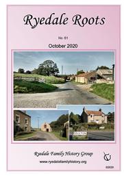
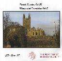
Ryedale Roots Journal October 2020 - Coulton
The Ryedale FHG Quarterly Journal ‘Keep your feet dry!’ A letter from Thomas England, West Indies Merchant and Ship-owner Extracts from ‘Annals of Yorkshire’ (available on the RFHG website) Introduction to our new Treasurer – Tony Pink Remembering Fireworks and ‘Mischief Night’ by Ron Scales Member Talks: The Women’s Land Army; Adoption; Help sought on: Smith and Todd (Ampleforth), Marshall (Appleton-le-Street),…
Supplied by: Ryedale Family History Group Product Ref: RFH-J.10.2020
The Streets of Westminster in the Census of 1851
A 28-page A5 illustrated LWMFHS booklet contains a list of all the street names in Westminster which appear in the 1851 census returns, which it is hoped will be useful information for the genealogical researcher. This area was in the county of Middlesex but is now in the City of Westminster London Borough.
Supplied by: London Westminster & Middlesex Family History Society (LWMFHS) Product Ref: LWM-CG001
The Streets of the City of London in the Census of 1851
A 48-page A5 illustrated LWMFHS booklet contains a list of all the street names in the City of London which appear in the 1851 census returns, which it is hoped will be useful information for the genealogical researcher.
Supplied by: London Westminster & Middlesex Family History Society (LWMFHS) Product Ref: LWM-CG002
Clerkenwell - second edition out now
This second edition of our popular Clerkenwell booklet – now with an extra 36 pages! - contains an updated list of the main records of interest to the genealogical researcher for the area based on the ancient parish of Clerkenwell, which includes the districts of Amwell, Charterhouse, Goswell Street and Pentonville. This area was in the county of Middlesex but is now in the London Borough of Islington.…
Supplied by: London Westminster & Middlesex Family History Society (LWMFHS) Product Ref: LWM-2PG001
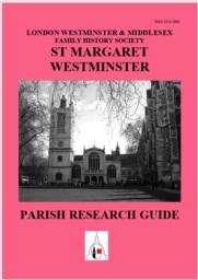
St Margaret Westminster - second edition out now
Out now is our revised, updated and expanded list of the main records of interest to the genealogical researcher for the area based on the ancient parish of St Margaret Westminster, which includes Downing Street, St John Smith Square, Westminster Abbey, Whitehall and a large detached area around Knightsbridge. This parish was known as St Margaret & St John from 1728-1922 and this was the name of…
Supplied by: London Westminster & Middlesex Family History Society (LWMFHS) Product Ref: LWM-2PG009
Kent FHS CD 38 Parish Registers Volume 22 and Monumental Inscriptions Volume 2 Free P&P
The records on the CD have been transcribed by members of Kent Family History Society and are in pdf format. A program such as Adobe Acrobat Reader DC is required. If you have a query about any of our publications please e-mail [email protected] The following indexes are included on the CD Ashford, St Mary Bur. 1793-1872 St Margaret at Cliffe Bap 1573-1906 Upper Hardres Bap. 1764-1838 Mar 1754-1838…
Supplied by: Kent Family History Society Product Ref: KFS-CD 38
Kent FHS CD 18 Marriage Licences issued from Canterbury. Trade Directories etc., for Whitstable & District. Free P&P
The CD has scanned images - not automatically searchable. Marriages are from many Kent parishes and also 'Strays'. Marriage Licences from 1568 to 1750. Approx. 65,000 entries. (1154 pages) These are detailed transcripts containing most of the Licence information. Six files for different periods in the above range, each in alphabetical order by GROOM. Indexes for BRIDE, non-Kent Parishes & Trades…
Supplied by: Kent Family History Society Product Ref: KFS-CD 18
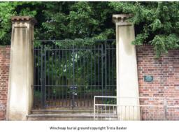
Canterbury, Kent - monumental inscriptions for Wincheap non-conformist burial ground
Monumental inscriptions for the Wincheap non-conformist burial ground, Canterbury. Originally published on microfiche 1 and CD no 37 the fiche contains notes on its history with a plan of the churchyard and details of the actual inscriptions together with searchable modern indexes presented in name and grave order. Also on the fiche are details of the only surviving tomb in the burial ground of the…
Supplied by: Kent Family History Society Product Ref: KFS-DLMI24
Maidstone and Tovil, Kent - Monumental inscriptions
The Maidstone and Tovil Tomb list was originally published on microfiche 1712 and CD no 38. The fiche contains a list of names recorded c1871 in the following burial grounds All Saints new burial ground The Proprietary Burial Ground in Brewer Street, Maidstone The ancient non-conformist burial ground in Tovil There is also a searchable modern index Monumental inscriptions for the Tovil Anabaptist Burial…
Supplied by: Kent Family History Society Product Ref: KFS-DLMI62
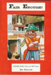
Fair Enough - Pinner Fair: The Last 200 Years
The annual street fair at Pinner in Middlesex was founded in 1336 and has been held ever since. At frequent intervals over the past two hundred years, people have been trying to suppress it for a variety of reasons. This book looks at the changing style of entertainments provided at the Fair, and examines the ways in which it has survived for over 650 years, when many neighbouring fairs and more famous…
Supplied by: Pinner Local History Society Product Ref: PIN-1008
Old West Linton by T.C. Atkinson
Dating from the days when West Linton had a railway station, these sixty photographs represent the village when it was just beginning to attract new settlers from Edinburgh and when a trip down the main street by a wealthy local in his new car could still bring the crowds out to watch. The book also features images of Carlops, Lamancha, Romanno Bridge, Mountain Cross, Blyth Bridge, Kirkcurd and Dolphinton. …
Supplied by: Lothians Family History Society Product Ref: LOT-SL006
Old Cockenzie and Port Seton by Bernard Byrom
The book includes illustrations and commentaries of the fishing industry at Port Seton. There are photographs of street scenes and famous local houses as well as scenes of leisure activities including Seton Sands Camping Ground opened in 1924.
Supplied by: Lothians Family History Society Product Ref: LOT-SL0051
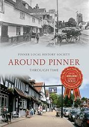
Around Pinner Through Time
Pinner was one of the ancient villages of Middlesex. Lanes led from its High Street to small hamlets, a handful of grand houses, the common fields, woods, and places further afield. By the nineteenth century, the countryside was a patchwork of farms, supplying London's needs. People came to Pinner from home counties, and then from London by railway. Villas appeared in the hamlets, and the expanding…
Supplied by: Pinner Local History Society Product Ref: PIN-1020
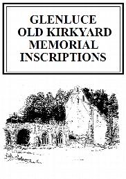
Glenluce Old Churchyard Memorial Inscriptions (2017)
This is a 60 page book of Memorial Inscriptions for Glenluce Old Churchyard (also known as Glenjorrie) in the town of Glenluce in the Parish of Old Luce, Wigtownshire. It includes inscriptions from Glenluce Abbey. It was published in 2017 and consists of 42 pages of inscriptions from 263 headstones. It is indexed by Surname only. A Parish Map is included and a Churchyard plan. Also a List of Ministers. There…
Supplied by: Dumfries and Galloway Family History Society Product Ref: DGF-GLEOMI-2017
Battle’s 1791 Directory of Hull
This was Hull’s first street directory, published in 1791 by Robert Battle.
Supplied by: East Yorkshire Family History Society Product Ref: EYK-CDH001-PCG2
Goole 1905
Dated 1905. Sheet 273.16b. 25in to the mile This detailed map covers the town of Goole, which was a small village until the 1820s but where the Aire & Calder Navigation Company then established a new town. Docks were built for the transhipment of goods from the Knottingley & Goole Canal to seagoing vessels. This map covers most of the town and features include station, St John's church, North…
Supplied by: East Yorkshire Family History Society Product Ref: EYK-G010-GM1
Great Driffield 1909
Dated 1909. Sheet 161.12. 25in to the mile This detailed map covers Great Driffield, where the Market Place, created in 1799, was the commercial hub of the town. The map covers most of the town, and features include the railway and station, Workhouse, cottage hospital, Cattle Market, All Saints church, Highfield, St John's church, Easterfield House, Cross Hill, Middle Street and Market Place. On the…
Supplied by: East Yorkshire Family History Society Product Ref: EYK-G011-GM1
Hunmanby 1926
Dated 1926. Sheet 110.11. 25in to the mile This map captures the small town of Hunmanby in detail and with its directory provides good historical coverage. Features on the map include the railway with station, brick works, town centre, Hunmanby Hall, Parkhouse Farm, All Saints church, Bridlington Street, Ratten Row, Stonegate, Northgate, Cross Hill, Hungate Lane, Low Hall and Harbour Hill. A directory…
Supplied by: East Yorkshire Family History Society Product Ref: EYK-G027-GM1
York (NE) & Heworth 1889
Dated 1889. Sheet 174.07. 25in to the mile This map covers the east of the city, including Layerthorpe and Heworth. Features include Red Tower and stretch of walls, Foss Islands Branch railway, gasworks, Monk Bridge, Layerthorpe Bridge, River Foss, workhouse, brick yards and glass works, old windmill, Heworth village, The Glen, Tang Hall, Holy Trinity church, Burnholme, Heworth Hall, Heworth Cottage…
Supplied by: East Yorkshire Family History Society Product Ref: EYK-G036-GM1
Vale of York (South) 1905-1913
Dated 1905-13. Sheet 71. 1in to mile This One Inch to the Mile map covers the area of the Yorkshire Plain south and east of York. Coverage stretches from the southern outskirts of York (ie including the racecourse but not the city centre) southward to Selby, and from Appleton Roebuck eastward to Nunburnholme station and Everingham station. Apart from Selby, towns on the map include Cawood and Pocklington.…
Supplied by: East Yorkshire Family History Society Product Ref: EYK-G037-GM1
Whitby 1911
Dated 1911. Sheet 032.07. 25in to the mile This highly detailed map covers the coastal town of Whitby. As expected, it is crowded with the narrow streets and alleys that lead up from the harbour, each tiny house meticulously shown. The map covers virtually all the town and major features include (on the east bank) the great Abbey, St Mary's church, Abbey House, Workhouse, East Cliff, Church Street,…
Supplied by: East Yorkshire Family History Society Product Ref: EYK-G038-GM1
Yorkshire Wolds (North) 1905
Dated 1905. Sheet 64. 1in to mile This One Inch to the Mile map covers the area from Fridaythorpe and Huggate Wold eastward to Burton Agnes; and from Langtoft and Tog Dale southward to Cranswick and North Dalton. Great Driffield, near the centre of the map, is the only town shown, though there are many small villages. On the reverse, a detailed map of Wetwang is included, together with a directory. It…
Supplied by: East Yorkshire Family History Society Product Ref: EYK-G042-GM1
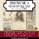
Browne's General Law-List 1780
Alphabetical Register of the names and residence of all the Judges, Sergeants, Counsellors, Attornies, Officers, Commissioners, Doctors, Proctors, Bankers, etc.... *Digitally enhanced images of the original text *Bookmarked by major headings *Fully printable
Supplied by: S&N Genealogy Supplies Product Ref: SNG-5633
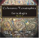
Collectanea Topographica et Genealogica Volume 4
Originally published as a quarterly magazine, the Collectanea Topographica et Genealogica is a selection of important documents. Volume 4 includes details of roll of arms, pedigrees, funeral certificates, burials, parish register extracts, deeds, charters, wills, and a contents of volumes 1 - 4. * Digitally enhanced images of the original text * Searchable text * Bookmarked by major headings * Fully…
Supplied by: S&N Genealogy Supplies Product Ref: SNG-4053