Product Search
Cardigan 1834 A3 Map
detailed coloured street map [sent in tube]
Supplied by: The Mclaughlin Guides and Buckinghamshire related books and historic maps Product Ref: BGS-M16
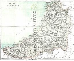
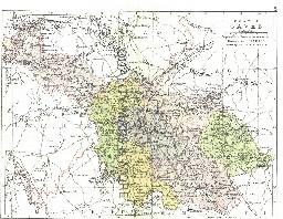
CARDIGAN 1883
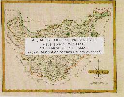
A QUALITY A3 SIZE COLOUR REPRODUCTION FROM AN 1883 ATLAS. LASER PRINTER ON GOOD QUALITY CARTRIDGE PAPER. SENT FOLDED IN A PLASTIC DISPLAY SLEEVE IN A STIFF CARD ENVELOPE AT THE LARGE LETTER RATE. SCALES VARY
Supplied by: Quality Maps and More Product Ref: QMM-MP412
Carlisle 1801 A3 Map
detailed coloured street map [sent in tube]
Supplied by: The Mclaughlin Guides and Buckinghamshire related books and historic maps Product Ref: BGS-M17
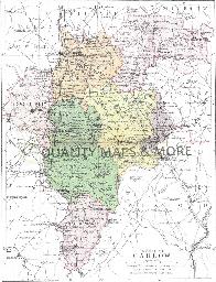
CARLOW 1882
A QUALITY A3 SIZE COLOUR REPRODUCTION FROM PHILIP'S 1882 ATLAS. LASER PRINTER ON GOOD QUALITY CARTRIDGE PAPER. SENT FOLDED IN A PLASTIC DISPLAY SLEEVE IN A STIFF CARD ENVELOPE AT THE LARGE LETTER RATE. SCALES VARY [WATERMARKS WILL NOT SHOW ON PURCHASES]
Supplied by: Quality Maps and More Product Ref: QMM-MP203
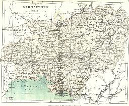
CARMARTHEN 1883
A QUALITY A3 SIZE COLOUR REPRODUCTION FROM AN 1883 ATLAS. LASER PRINTER ON GOOD QUALITY CARTRIDGE PAPER. SENT FOLDED IN A PLASTIC DISPLAY SLEEVE IN A STIFF CARD ENVELOPE AT THE LARGE LETTER RATE. SCALES VARY
Supplied by: Quality Maps and More Product Ref: QMM-MP413
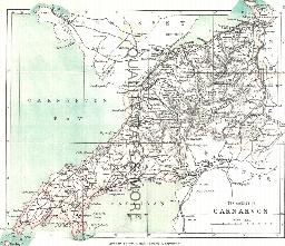
CARNARVON 1883
A QUALITY A3 SIZE COLOUR REPRODUCTION FROM AN 1883 ATLAS. LASER PRINTER ON GOOD QUALITY CARTRIDGE PAPER. SENT FOLDED IN A PLASTIC DISPLAY SLEEVE IN A STIFF CARD ENVELOPE AT THE LARGE LETTER RATE. SCALES VARY
Supplied by: Quality Maps and More Product Ref: QMM-MP414
CAVAN 1882
A QUALITY A3 SIZE COLOUR REPRODUCTION FROM PHILIP'S1882 ATLAS. LASER PRINTER ON GOOD QUALITY CARTRIDGE PAPER. SENT FOLDED IN A PLASTIC DISPLAY SLEEVE IN A STIFF CARD ENVELOPE AT THE LARGE LETTER RATE. SCALES VARY [WATERMARKS WILL NOT SHOW ON PURCHASES]
Supplied by: Quality Maps and More Product Ref: QMM-MP204
CD 16 EARLY 20th CENTURY LONDON: MAPS, STREET NAMES and SCHOOLS. Nov 2009.
Compiled and indexed by Chris Willis, edited by Sue Turner, 2009. This CD contains the six Board School Maps of London, produced in 1906/7 by the London Schools Authorities. They were based on the 6" Ordnance Survey stock of the time and over printed with boundaries of the areas used in controlling the schools and also with the actual schools. To provide an index into the maps, a Street index (published…
Supplied by: West Surrey Family History Society Product Ref: WSY-CD16
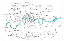
CD 43 General Indexes to Old Ordnance Survey Maps of London
CD 43 General Indexes to Old Ordnance Survey Maps of London (Godfrey Edition). Research in Victorian London very soon gives rise to the question "where is such-and-such a street?". It may be on a modern map, but quite often is not. The re-publication of early Ordnance Survey 1:2500 maps in the reduced scale Godfrey Edition gives the researcher a chance but, even if the street is on the sheet one has…
Supplied by: West Surrey Family History Society Product Ref: WSY-CD43c
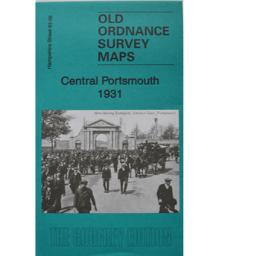
Central Portsmouth 1931
As well as the map there is a local history written by Tony Painter and extracts from Kelly's Directory for Hampshire, 1927.
Supplied by: Hampshire Genealogical Society Product Ref: HAM-13966846
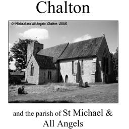
Chalton (Village Booklet 58)
The village of Chalton and the parish of St. Michael & All Angels
Supplied by: Hampshire Genealogical Society Product Ref: HAM-16058
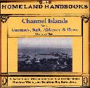
Channel Islands, The Homeland Handbooks - Part 1 Guernsey, Sark, Alderney & Herm - Ordnance Map for 1933 (approx)
This guide provides invaluable background information on Channel Islands Part 1 Guernsey, Sark, Alderney and Herm in the 1900's. This official council guide has maps, photographs and illustrations. It covers the history, traditions, worthies, antiquities and literary associations. This CD is a useful guide with information and details about the area where your relatives may have lived. \*Digitally…
Supplied by: S&N Genealogy Supplies Product Ref: SNG-3586
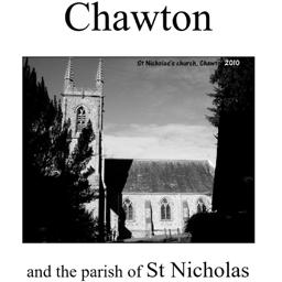
Chawton (Village Booklet 47)
The village of Chawton and the parish of St. Nicholas.
Supplied by: Hampshire Genealogical Society Product Ref: HAM-16047
Cheadle Hulme (South) 1907
Cheadle Hulme, south of Manchester
Supplied by: Northern Writers Advisory Services Product Ref: NWA-ASH19
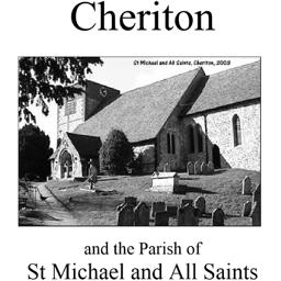
Cheriton (Village Booklet 23)
The village of Cheriton and the parish of St. Michael and All Saints.
Supplied by: Hampshire Genealogical Society Product Ref: HAM-16023
Chesham Town; Tithe Map 1844
map with plot numbers, with a booklet list and index of all househoilders and what they owned. [sent in tube]
Supplied by: The Mclaughlin Guides and Buckinghamshire related books and historic maps Product Ref: BGS-B63
CHESHIRE 1787
A QUALITY A3 SIZE COLOUR REPRODUCTION FROM JOHN CARY'S 1787 ATLAS WITH DETAILS OF THE COUNTY OVERLEAF. LASER PRINTER ON GOOD QUALITY CARTRIDGE PAPER. SENT FOLDED IN A PLASTIC DISPLAY SLEEVE IN A STIFF CARD ENVELOPE AT THE LARGE LETTER RATE. SCALES VARY
Supplied by: Quality Maps and More Product Ref: QMM-MP105
Cheshire 1837 A3 County Map
detailed coloured county map [sent in tube]
Supplied by: The Mclaughlin Guides and Buckinghamshire related books and historic maps Product Ref: BGS-M65
Chester 1801 A3 Map
detailed coloured street map [sent in tube]
Supplied by: The Mclaughlin Guides and Buckinghamshire related books and historic maps Product Ref: BGS-M18
Chichester 1812 A3 Map
detailed coloured street map [sent in tube]
Supplied by: The Mclaughlin Guides and Buckinghamshire related books and historic maps Product Ref: BGS-M19
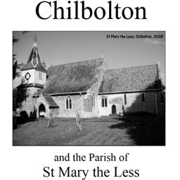
Chilbolton (Village Booklet 22)
The village of Chilbolton and the parish of St. Mary the Less.
Supplied by: Hampshire Genealogical Society Product Ref: HAM-16022
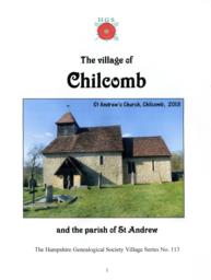
Chilcomb (Village Booklet 113)
Chilcomb Village and the Parish of St Andrew
Supplied by: Hampshire Genealogical Society Product Ref: HAM-16113
Chorlton cum Hard & Stretford
Chorlton cum Hardy and Stretford 1905 map
Supplied by: Northern Writers Advisory Services Product Ref: NWA-ASH26
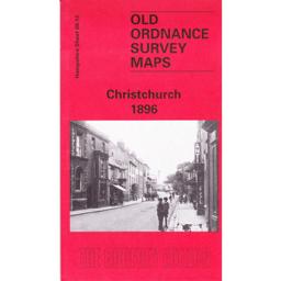
Christchurch 1896
To be updated shortly
Supplied by: Hampshire Genealogical Society Product Ref: HAM-13966707
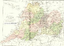
CLARE 1882
A QUALITY A3 SIZE COLOUR REPRODUCTION FROM PHILIP'S 1882 ATLAS. LASER PRINTER ON GOOD QUALITY CARTRIDGE PAPER. SENT FOLDED IN A PLASTIC DISPLAY SLEEVE IN A STIFF CARD ENVELOPE AT THE LARGE LETTER RATE. SCALES VARY [WATERMARKS WILL NOT SHOW ON PURCHASES]
Supplied by: Quality Maps and More Product Ref: QMM-MP205