Product Search
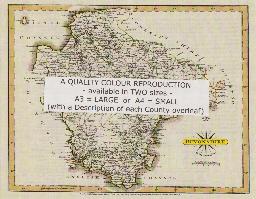
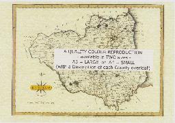
DEVONSHIRE 1787
A QUALITY A3 SIZE COLOUR REPRODUCTION FROM JOHN CARY'S 1787 ATLAS WITH DETAILS OF THE COUNTY OVERLEAF. LASER PRINTER ON GOOD QUALITY CARTRIDGE PAPER. SENT FOLDED IN A PLASTIC DISPLAY SLEEVE IN A STIFF CARD ENVELOPE AT THE LARGE LETTER RATE. SCALES VARY
Supplied by: Quality Maps and More Product Ref: QMM-MP109
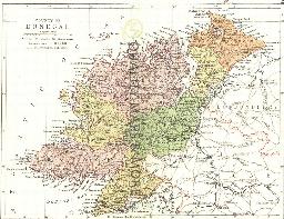
DONEGAL 1882
A QUALITY A3 SIZE COLOUR REPRODUCTION FROM PHILIP'S 1882 ATLAS. LASER PRINTER ON GOOD QUALITY CARTRIDGE PAPER. SENT FOLDED IN A PLASTIC DISPLAY SLEEVE IN A STIFF CARD ENVELOPE AT THE LARGE LETTER RATE. SCALES VARY [WATERMARKS WILL NOT SHOW ON PURCHASES]
Supplied by: Quality Maps and More Product Ref: QMM-MP207
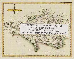
DORSET 1787
A QUALITY A3 SIZE COLOUR REPRODUCTION FROM JOHN CARY'S 1787 ATLAS WITH DETAILS OF THE COUNTY OVERLEAF. LASER PRINTER ON GOOD QUALITY CARTRIDGE PAPER. SENT FOLDED IN A PLASTIC DISPLAY SLEEVE IN A STIFF CARD ENVELOPE AT THE LARGE LETTER RATE. SCALES VARY
Supplied by: Quality Maps and More Product Ref: QMM-MP110
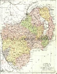
DOWN 1882
A QUALITY A3 SIZE COLOUR REPRODUCTION FROM PHILIP'S 1882 ATLAS. LASER PRINTER ON GOOD QUALITY CARTRIDGE PAPER. SENT FOLDED IN A PLASTIC DISPLAY SLEEVE IN A STIFF CARD ENVELOPE AT THE LARGE LETTER RATE. SCALES VARY [WATERMARKS WILL NOT SHOW ON PURCHASES]
Supplied by: Quality Maps and More Product Ref: QMM-MP208
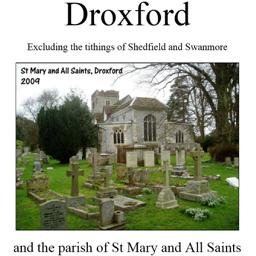
Droxford (Village Booklet 79)
The village of Droxford and the parish of Sy Mary and All Saints. Excluding the tithings of Shedfield and Swanmore.
Supplied by: Hampshire Genealogical Society Product Ref: HAM-16079
Dublin 1833 A3 Map
detailed coloured street map [sent in tube]
Supplied by: The Mclaughlin Guides and Buckinghamshire related books and historic maps Product Ref: BGS-M24
DUBLIN County 1882
A QUALITY A3 SIZE COLOUR REPRODUCTION FROM PHILIP'S 1882 ATLAS. LASER PRINTER ON GOOD QUALITY CARTRIDGE PAPER. SENT FOLDED IN A PLASTIC DISPLAY SLEEVE IN A STIFF CARD ENVELOPE AT THE LARGE LETTER RATE. SCALES VARY [WATERMARKS WILL NOT SHOW ON PURCHASES]
Supplied by: Quality Maps and More Product Ref: QMM-MP209
DUMBARTON 1845
A QUALITY A3 SIZE COLOUR REPRODUCTION FROM THE NEW STATISTICAL ACCOUNT OF SCOTLAND 1845. MOST MAPS HAVE THE PARISHES OUTLINED LASER PRINTER ON GOOD QUALITY CARTRIDGE PAPER. SENT FOLDED IN A PLASTIC DISPLAY SLEEVE IN A STIFF CARD ENVELOPE AT THE LARGE LETTER RATE. SCALES VARY [WATERMARKS WILL NOT SHOW ON PURCHASES]
Supplied by: Quality Maps and More Product Ref: QMM-MP308
DUMFRIES 1845
A QUALITY A3 SIZE COLOUR REPRODUCTION FROM THE NEW STATISTICAL ACCOUNT OF SCOTLAND 1845. MOST MAPS HAVE THE PARISHES OUTLINED LASER PRINTER ON GOOD QUALITY CARTRIDGE PAPER. SENT FOLDED IN A PLASTIC DISPLAY SLEEVE IN A STIFF CARD ENVELOPE AT THE LARGE LETTER RATE. SCALES VARY [WATERMARKS WILL NOT SHOW ON PURCHASES]
Supplied by: Quality Maps and More Product Ref: QMM-MP309
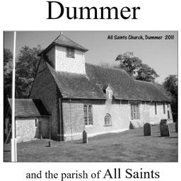
Dummer (Village Booklet 60)
The village of Dummer and the parish of All Saints.
Supplied by: Hampshire Genealogical Society Product Ref: HAM-16060
DURHAM 1787
A QUALITY A3 SIZE COLOUR REPRODUCTION FROM JOHN CARY'S 1787 ATLAS WITH DETAILS OF THE COUNTY OVERLEAF. LASER PRINTER ON GOOD QUALITY CARTRIDGE PAPER. SENT FOLDED IN A PLASTIC DISPLAY SLEEVE IN A STIFF CARD ENVELOPE AT THE LARGE LETTER RATE. SCALES VARY
Supplied by: Quality Maps and More Product Ref: QMM-MP111
Durham 1801 A3 Map
detailed coloured street map [sent in tube]
Supplied by: The Mclaughlin Guides and Buckinghamshire related books and historic maps Product Ref: BGS-M25
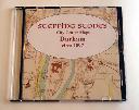
Durham Map CD (c.1897)
Stepping Stones publication Durham City Centre Map CD (c.1897)
Supplied by: S&N Genealogy Supplies Product Ref: SNG-5100

East and West Wellow (Village Booklet 83)
The villages of East and West Wellow and the parish of St Margaret of Antioch
Supplied by: Hampshire Genealogical Society Product Ref: HAM-16083
East Ilsley in the 1830s [CD]
by Sue Burnay & Nigel Wardell - an interactive map based on a pre-tithe map of 1831, together with its associated terrier, listing the owners, occupiers, descriptions etc. of every building and plot of land in the parish. A beautiful example of early 19th century map-making - high resolution scans mean that every detail is visible.
Supplied by: Sigma Books Product Ref: SIG-1831
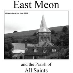
East Meon (Village Booklet 3)
The village of East Meon and the parish of All Saints.
Supplied by: Hampshire Genealogical Society Product Ref: HAM-16003
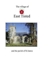
East Tisted (Village Booklet 98)
Village of East Tisted and the Parish of St James
Supplied by: Hampshire Genealogical Society Product Ref: HAM-16098
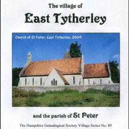
East Tytherley (Village Booklet 89)
The village of East Tytherley and the parish of St Peter
Supplied by: Hampshire Genealogical Society Product Ref: HAM-16089
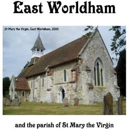
East Worldham (Village Booklet 81)
The village of East Worldham and the parish of the St Mary the Virgin.
Supplied by: Hampshire Genealogical Society Product Ref: HAM-16081
East Yorkshire Family History Society Parish Map
A map showing all the Church of England parishes in the East Yorkshire Family History Society area. It includes where the Parish Registers are now held, the boundaries of the 14 Civil Registration Districts and the earliest register dates of churches in Scarborough, Bridlington, Beverley, Malton-Norton and present day Kingston upon Hull. Revised June 2006. This item is A3 in size and delivered folded…
Supplied by: East Yorkshire Family History Society Product Ref: EYK-A005-PCA1
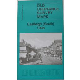
Eastleigh (South) 1908
As well as the map there is a local history written by Alan Godfrey and extracts from Kelly's Directory for Hampshire, 1899.
Supplied by: Hampshire Genealogical Society Product Ref: HAM-13966822
Eastwood and Parkgate Works 1901
Map of district on northern edge of Rotherham.
Supplied by: Sheffield & District Family History Society Product Ref: SHE-G70103
Ecclesall Road and Sharrow 1903
Map of populous area to immediate south of the city centre.
Supplied by: Sheffield & District Family History Society Product Ref: SHE-G70104
Ecclesall Village 1902
Map of rural area around Ecclesall parish church.
Supplied by: Sheffield & District Family History Society Product Ref: SHE-G70105
Ecclesfield 1901
Map of village in north of Sheffield.
Supplied by: Sheffield & District Family History Society Product Ref: SHE-G70106