Product Search
Lancashire Local Historian 9 (1994)
And the blowshoppes decay for lakke of wood; How did Thomas Pennant cross the Ribble?; Poverty and the Poor Law in Formby, 1701-1900; A poor diet for poor people? Workhouse food in Lancashire, 1750-1834; In defence of the shopkeeper; Irish Nationalists in Bootle, 1868-1914; St. Mary's School goes to war; Killing the pig; Rainford in the 1940s
Supplied by: Northern Writers Advisory Services Product Ref: NWA-OHL1
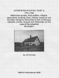
Altrincham Lives: Part 4, 1721-1760
ALTRINCHAM LIVES: PART 4, 1721-1760 Altrincham people, their politics, religion, agriculture, housing, food, clothes, weapons and luxuries, transport, Altrincham’s first workhouse, bakeries, privies, lawyers and Altrincham on the cusp of the Industrial Revolution
Supplied by: Northern Writers Advisory Services Product Ref: NWA-22
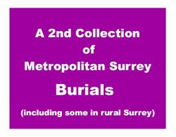
CD29 A 2nd Collection of METROPOLITAN Surrey Burials Index (including some Rural parishes)
Transcriptions and indexes. September 2012 An Index of over 247,000 burials - 231,480 from Metropolitan Surrey and 15,522 from Rural Surrey. The following parishes are included: METROPOLITAN SURREY: Battersea Christ Church 1862-1866, (263); Battersea St Mary 1778-1865, (9,266); Bermondsey St James 1829-1854, 1862-1879, (7,595); Bermondsey St Mary Magdalen 1674-1688, 1700-1724/5, 1738/9-1764, 1786-1794,…
Supplied by: West Surrey Family History Society Product Ref: WSY-CD29
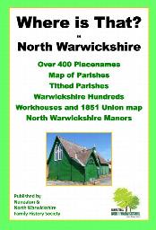
Where is that? in north Warwickshire
Over 400 place names, map of parishes, Tithed parishes, Warwickshire Hundreds, 1851 Workhouse Unions map and North Warwickshire Manors.
Supplied by: Nuneaton & North Warwickshire Family History Society (NNWFHS) Product Ref: NUN-101
Historic Barnet
A series of short articles on the history of Chipping Barnet and the surrounding area. Includes the Battle of Barnet, Barnet Physic Well, Barnet Workhouse, the coming of the railways to Barnet, Barnet Fair and much more.
Supplied by: Barnet Museum and Local History Society Product Ref: BTM-001
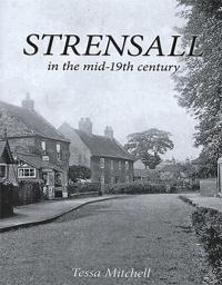
Strensall in the mid 19th Century
Originally written in 1989 by Tessa Mitchell, this book has been out of print for many years. We are delighted to have been able to assist Tessa with this reprinted version which is now available at our Research Room and here on our website. Tessa’s Preface: The idea for this book was born on the realisation that it was possible to match the families that were resident in the township in 1849-51 with…
Supplied by: Ryedale Family History Group Product Ref: RFH-misc-d029

Strensall in the mid 19th Century
Originally written in 1989 by Tessa Mitchell, this book has been out of print for many years. We are delighted to have been able to assist Tessa with this reprinted version which is now available at our Research Room and here on our website. Tessa’s Preface: The idea for this book was born on the realisation that it was possible to match the families that were resident in the township in 1849-51 with…
Supplied by: Ryedale Family History Group Product Ref: RFH-misc-bk020
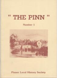
Pinn 1
The Stench of Progress - Report of the Nuisances Committee 1871; John Mayall, photographer 1810-1901; Pinner mobility - transport in the early 19th century; Moss Close and footpath; Hedges and Trees in Pinner; The Barrow Point Estate - a history; The workhouse and the poor of Pinner - 1782-1845
Supplied by: Pinner Local History Society Product Ref: PIN-1014
Great Driffield 1909
Dated 1909. Sheet 161.12. 25in to the mile This detailed map covers Great Driffield, where the Market Place, created in 1799, was the commercial hub of the town. The map covers most of the town, and features include the railway and station, Workhouse, cottage hospital, Cattle Market, All Saints church, Highfield, St John's church, Easterfield House, Cross Hill, Middle Street and Market Place. On the…
Supplied by: East Yorkshire Family History Society Product Ref: EYK-G011-GM1
York (NE) & Heworth 1889
Dated 1889. Sheet 174.07. 25in to the mile This map covers the east of the city, including Layerthorpe and Heworth. Features include Red Tower and stretch of walls, Foss Islands Branch railway, gasworks, Monk Bridge, Layerthorpe Bridge, River Foss, workhouse, brick yards and glass works, old windmill, Heworth village, The Glen, Tang Hall, Holy Trinity church, Burnholme, Heworth Hall, Heworth Cottage…
Supplied by: East Yorkshire Family History Society Product Ref: EYK-G036-GM1
Beverley (North) 1908
Dated 1908. Sheet 210.08. 25in to the mile Two maps for Beverley have been published. These link up with each other to provide excellent coverage of the town. This map covers the centre of Beverley, with coverage extending from Highgate and Eastgate northward to Scrubwood Lane. Features include town centre with individual buildings neatly shown, railway with station, Market Cross, Wednesday Market,…
Supplied by: East Yorkshire Family History Society Product Ref: EYK-G004-GM1
Bridlington (North) 1909
Dated 1909. Sheet 146.02. 25in to the mile Two maps for Bridlington have been published. These link up with each other to provide excellent coverage of the town. This map covers the Old Town and the North Shore area, and is double-sided for maximum coverage. Features include Priory Church, MarketPlace, Bridlington Workhouse, Stepney Hall, Old Town shown in detail with individual buildings neatly shown,…
Supplied by: East Yorkshire Family History Society Product Ref: EYK-G015-GM1
Hull (North West) 1909
Dated 1909. Sheet 226.14. 25in to the mile This detailed map covers the busy NW area of Hull, with coverage stretching from Perth Street and Richmond Street eastward to Waterloo Street, and from Welbeck Street northward to Torrington Street. This is a mainly residential area with many streets of terraces. Features include Pearson's Park, Beverley Road station, tramways, Sculcoates Workhouse, Stepney…
Supplied by: East Yorkshire Family History Society Product Ref: EYK-G023-GM1
Hull (West) 1908
Dated 1908. Sheet 240.02a. 25in to the mile Three versions of this detailed map have been published (1890, 1908 & 1928), showing how the area developed across the years. The 1890 map is colour printed, from the beautiful OS handcoloured First Edition. The map covers a very busy area of west Hull, with coverage stretching from Albert Avenue and Plane Street eastward to Prospect Street and Paragon…
Supplied by: East Yorkshire Family History Society Product Ref: EYK-G025-GM1
Hull (West) 1928
Dated 1928. Sheet 240.02b. 25in to the mile Three versions of this detailed map have been published (1890, 1908 & 1928), showing how the area developed across the years. The 1890 map is colour printed, from the beautiful OS handcoloured First Edition. The map covers a very busy area of west Hull, with coverage stretching from Albert Avenue and Plane Street eastward to Prospect Street and Paragon…
Supplied by: East Yorkshire Family History Society Product Ref: EYK-G026-GM1
Whitby 1911
Dated 1911. Sheet 032.07. 25in to the mile This highly detailed map covers the coastal town of Whitby. As expected, it is crowded with the narrow streets and alleys that lead up from the harbour, each tiny house meticulously shown. The map covers virtually all the town and major features include (on the east bank) the great Abbey, St Mary's church, Abbey House, Workhouse, East Cliff, Church Street,…
Supplied by: East Yorkshire Family History Society Product Ref: EYK-G038-GM1
Hull (West) 1890
Dated 1890. Sheet 240.02a. 25in to mile, coloured Three versions of this detailed map have been published (1890, 1908 & 1928), showing how the area developed across the years. The 1890 map is colour printed, from the beautiful OS handcoloured First Edition. The map covers a very busy area of west Hull, with coverage stretching from Albert Avenue and Plane Street eastward to Prospect Street and…
Supplied by: East Yorkshire Family History Society Product Ref: EYK-G048-GM2
Cornish Baptisms - A (by surname) 1570 - 1894
Over 5,000 records from various parishes for surnames beginning with the letter A. These transcriptions are taken from the actual parish records, Bodmin Transcripts and Exeter Transcripts available at the County Records Office, Truro, Cornwall.
Supplied by: S&N Genealogy Supplies Product Ref: SNG-5556

Cornish Baptisms - B (by surname) 1562 - 1900
Over 29,000 records from various parishes for surnames beginning with the letter B. These transcriptions are taken from the actual parish records, Bodmin Transcripts and Exeter Transcripts available at the County Records Office, Truro, Cornwall.
Supplied by: S&N Genealogy Supplies Product Ref: SNG-5557
Cornish Baptisms - C (by surname) 1561 - 1900
Over 24,000 records from various parishes for surnames beginning with the letter C. These transcriptions are taken from the actual parish records, Bodmin Transcripts and Exeter Transcripts available at the County Records Office, Truro, Cornwall.
Supplied by: S&N Genealogy Supplies Product Ref: SNG-5558
Cornish Baptisms - D (by surname) 1562 - 1900
Over 11,000 records from various parishes for surnames beginning with the letter D. These transcriptions are taken from the actual parish records, Bodmin Transcripts and Exeter Transcripts available at the County Records Office, Truro, Cornwall.
Supplied by: S&N Genealogy Supplies Product Ref: SNG-5559
Cornish Baptisms - E & F (by surname) 1587 - 1898
Over 9,000 records from various parishes for surnames beginning with the letters E and F. These transcriptions are taken from the actual parish records, Bodmin Transcripts and Exeter Transcripts available at the County Records Office, Truro, Cornwall.
Supplied by: S&N Genealogy Supplies Product Ref: SNG-5560

Cornish Baptisms - G (by surname) 1564 - 1900
Over 12,000 records from various parishes for surnames beginning with the letter G. These transcriptions are taken from the actual parish records, Bodmin Transcripts and Exeter Transcripts available at the County Records Office, Truro, Cornwall.
Supplied by: S&N Genealogy Supplies Product Ref: SNG-5561

Cornish Baptisms - H (by surname) 1562 - 1903
Over 27,000 records from various parishes for surnames beginning with the letter H. This CD contains transcriptions which are taken from the actual parish records, Bodmin Transcripts and Exeter Transcripts available at the County Records Office, Truro, Cornwall.
Supplied by: S&N Genealogy Supplies Product Ref: SNG-5589
Cornish Baptisms - I & J (by surname) 1562 - 1900
Over 13,000 records from various parishes for surnames beginning with the letters I and J. These transcriptions are taken from the actual parish records, Bodmin Transcripts and Exeter Transcripts available at the County Records Office, Truro, Cornwall.
Supplied by: S&N Genealogy Supplies Product Ref: SNG-5577