Product Search
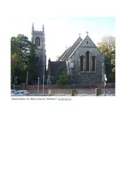
Chatham, Kent St Mary - Monumental inscriptions
Monumental inscriptions for the former parish church of St Mary, Chatham. Recorded in 1946, 1959, 1986 and 1994-95. After the opening of Chatham Cemetery in 1869 there were fewer burials in the church yard, the last burial took place in 1897 according to the register. In 1946 the Borough Surveyor of the former Chatham Council drew up a plan of the churchyard, numbered all surviving monuments and a…
Supplied by: Kent Family History Society Product Ref: KFS-DLMI31
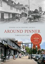
Around Pinner Through Time
Pinner was one of the ancient villages of Middlesex. Lanes led from its High Street to small hamlets, a handful of grand houses, the common fields, woods, and places further afield. By the nineteenth century, the countryside was a patchwork of farms, supplying London's needs. People came to Pinner from home counties, and then from London by railway. Villas appeared in the hamlets, and the expanding…
Supplied by: Pinner Local History Society Product Ref: PIN-1020

One-2-One Online Tuition - Workshop 3 "Research Techniques" Free P&P
Are you a complete beginner when it comes to researching your family history? Do you want to do a ‘do-over’?! If you’re not sure where to begin, I now offer 1-2-1 online tuition to help you get started or to help you start over again and do it better! I will recommend books and useful websites to help you get started. These workshops make great birthday and retirement gifts. Duration: 1 – 1.5 hours…
Supplied by: The Crafty Genealogist Product Ref: CGT-WKSP3
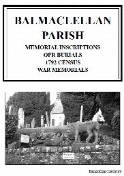
Balmaclellan Parish Memorial Inscriptions (2014)
This is a 84 page book of Memorial Inscriptions for Balmaclellan Parish Churchyard in the Parish of Balmaclellan, Dumfriesshire. It was published in 2014 and consists of 33 pages of inscriptions from 237 headstones. It is indexed by Surname only. It includes 468 Old Parish Register Burials indexed by Surname and Forename. Also included are the 122 entries from the 1792 Census plus an list of Place…
Supplied by: Dumfries and Galloway Family History Society Product Ref: DGF-BALMI-2014
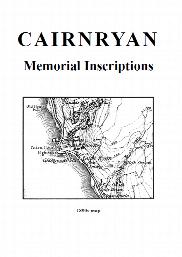
Cairnryan Cemetery Memorial Inscriptions (2003)
This is a 32 page book of Memorial Inscriptions for Cairnryan Cemetery in Cairnryan Village in the Parish of Inch, Wigtownshire. It was published in 2003 and consists of 13 pages of inscriptions from 100 headstones. It is indexed by Surname only. A Map of the area is included plus 1692 Hearth Tax List. Also 1684 Covenant Parish List by location and name. There is also a graveyard plan. Also in this…
Supplied by: Dumfries and Galloway Family History Society Product Ref: DGF-CAICMI-2003
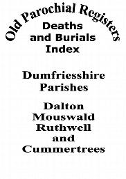
Dalton, Mouswald, Ruthwell and Cummertrees Old Parish Register Deaths and Burials (2006)
This is a 16 page book of Old Parish Register Deaths and Burials for the Parishes of Dalton, Cummertrees, Mouswald and Ruthwell, Dumfriesshire. It was published in 2006 and consists of 14 pages of 575 Deaths/Burials between the period: Cummertrees: 1733-1838 Dalton: 1766-1817 Mouswald: 1836-1861 Ruthwell: 1773-1775 Each Parish is listed by Surname and Forename. A Map is included of all parishes. Also…
Supplied by: Dumfries and Galloway Family History Society Product Ref: DGF-DMROPR-2006
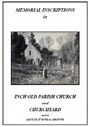
Inch Old Parish Churchyard Memorial Inscriptions (2002)
This is a 68 page book of Memorial Inscriptions for Inch Old Parish Churchyard near the Village of Castle Kennedy in the Parish of Inch, Wigtownshire. It was published in 2002 and consists of 50 pages of inscriptions from 344 headstones. It is indexed by Surname only. This book included 10 transcriptions of the Old Burial Ground at Soulseat Abbey. Also in this Parish are 3 other graveyards being Cairnryan…
Supplied by: Dumfries and Galloway Family History Society Product Ref: DGF-INCOMI-2002

Langholm Parish Staplegordon Graveyard Memorial Inscriptions (2020)
This is a 52 page book of Memorial Inscriptions for Langholm Staplegordon Graveyard in the Parish of Langholm, Dumfriesshire. It was re-published in 2020 to correct errors, standardise the layout and provide a detailed index. It consists of 28 pages of inscriptions from 231 headstones. It is fully indexed by Surname and Forename. A Parish Map is included together with a list of place names in the Parishes…
Supplied by: Dumfries and Galloway Family History Society Product Ref: DGF-LANSMI-2020
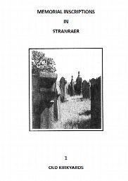
Stranraer Old Churchyards Memorial Inscriptions (2014)
This is a 56 page book of Memorial Inscriptions for Stranraer Old Churchyards in Stranraer Town in the Parish of Stranraer, Wigtownshire. It includes Burial Grounds in Bridge Street, Church Street, Dalrymple Street, Ivy Place and Thistle Street. It was published in 2018 and consists of 34 pages of inscriptions from 285 headstones. It is indexed by Surname only. A Location Map of graveyards in Stranraer…
Supplied by: Dumfries and Galloway Family History Society Product Ref: DGF-STROMI-2018

Stranraer Sheuchan Churchyard Memorial Inscriptions Sect 1 (2018)
This is a 68 page book of Memorial Inscriptions for Sheuchan Churchyard in Stranraer Town in the Parish of Leswalt, Wigtownshire. It was re-printed in 2018 and consists of 54 pages of inscriptions from 412 headstones. It is indexed by Surname only. Included is a map of the graveyard, and a location plan of the 7 graveyards in Stranraer. There is a second book for the Sheuchan Churchyard Extension. There…
Supplied by: Dumfries and Galloway Family History Society Product Ref: DGF-STR1MI-2018
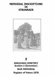
Stranraer Sheuchan Churchyard Extension Memorial Inscriptions Sect 2 (2018)
This is a 60 page book of Memorial Inscriptions for Sheuchan Churchyard Extension in Stranraer Town in the Parish of Leswalt, Wigtownshire. It was re-printed in 2018 and consists of 26 pages of inscriptions from 288 headstones. It is indexed by Surname only. Included is a map of the graveyard, and a location plan of the 7 graveyards in Stranraer. The main Sheuchan Churchyard is subject of a separate…
Supplied by: Dumfries and Galloway Family History Society Product Ref: DGF-STR2MI-2018
Hornsea 1926
Dated 1926. Sheet 197.03. 25in to the mile This detailed map covers the small town of Hornsea, a few miles east of Hull. The town lies between Hornsea Mere, part of which is shown on the map, and the sea. A port at Hornsea Beck, just east of the town, was destroyed by coastal erosion in the 16th century, but Hornsea developed as a modest seaside resort with the arrival of the railway in 1864. This…
Supplied by: East Yorkshire Family History Society Product Ref: EYK-G014-GM1
Hull Old Town 1853
Dated 1853. Sheet 12. Early Large Scale Maps This detailed map covers the much of the Old Town of Hull, the principal streets being Whitefriargate, Lowgate, Market Place, Mytongate, Blanket Row, Blackfriargate and Trinity House Lane. These are shown in great detail and features include Theatre Royal, South End Graving Dock, warehouses, Holy Trinity church, Trinity House, Watson's Hospital, Humber Dock,…
Supplied by: East Yorkshire Family History Society Product Ref: EYK-G024-GM1
Whitby 1911
Dated 1911. Sheet 032.07. 25in to the mile This highly detailed map covers the coastal town of Whitby. As expected, it is crowded with the narrow streets and alleys that lead up from the harbour, each tiny house meticulously shown. The map covers virtually all the town and major features include (on the east bank) the great Abbey, St Mary's church, Abbey House, Workhouse, East Cliff, Church Street,…
Supplied by: East Yorkshire Family History Society Product Ref: EYK-G038-GM1
Hull (Prospect Street) 1853
Dated 1853. Sheet 07. Early Large Scale Maps This detailed map covers the area around Prospect Street, stretching from College Street West eastward to Bond Street, and from Liddell Street southward to Temperance Street. Features include the General Infirmary, Waltham Street Chapel, Savings Bank School, Hull Ragged & Industrial School, St Stephen's church, West Street Brewery, and many streets of…
Supplied by: East Yorkshire Family History Society Product Ref: EYK-G046-GM1

Archival Quality Cotton Gloves (Large) Free P&P
Protect delicate items with these archival quality cotton gloves, designed to prevent fingerprints, oils and dirt from damaging valuable materials. Ideal for handling photographs, documents, prints, coins and other collectables, these soft white gloves provide a safe barrier while allowing careful, controlled handling. Made from breathable cotton, the gloves are comfortable to wear and gentle on sensitive…
Supplied by: S&N Genealogy Supplies Product Ref: SNG-5854

Archival Quality Cotton Gloves (Medium) Free P&P
Protect delicate items with these archival quality cotton gloves, designed to prevent fingerprints, oils and dirt from damaging valuable materials. Ideal for handling photographs, documents, prints, coins and other collectables, these soft white gloves provide a safe barrier while allowing careful, controlled handling. Made from breathable cotton, the gloves are comfortable to wear and gentle on sensitive…
Supplied by: S&N Genealogy Supplies Product Ref: SNG-5855

6 in 1 Multifunctional Pocket Magnifier
A compact and versatile tool for collectors, this handy magnifier features a built-in LED microscope (15x magnification) for examining the finest details of coins, stamps, banknotes, and more. It also includes two aspheric Perspex lenses for crystal-clear magnification - a large lens with 3x magnification and a small lens with 10x magnification - to allow an optimal view of images. There are three…
Supplied by: S&N Genealogy Supplies Product Ref: SNG-9677