Product Search
Malton & Norton 1926
Dated 1926. Sheet 124.06. 25in to the mile This map captures Malton in great detail, with individual houses neatly delineated. Three townships are shown: Old and New Malton, and the sister town of Norton on the other side of the Derwent. Malton is in the historic North Riding, Norton in the East Riding. The town centre of Malton, ie New Malton, gets the most complete coverage on our map; features here…
Supplied by: East Yorkshire Family History Society Product Ref: EYK-G028-GM1
York (South) 1907
Dated 1907. Sheet 174.10b. 25in to the mile This detailed map covers the southern part of York. Coverage stretches from Micklegate southward to Campleshon Lane, and from Fawcetts Street westward to New Lane and Murray Street. Features on the map include the southern tip of the station and its railway approaches, including carriage works, engine shed, Holgate Junction (shown in detail with track layout),…
Supplied by: East Yorkshire Family History Society Product Ref: EYK-G041-GM1
Scarborough (West) 1910
Dated 1910. Sheet 078.16. 25in to the mile This detailed map covers the west of Scarborough with coverage extending from Victoria Road westward to Stepney Hill and Throxenby Hall. Features include Falsgrave, St James church, Hydropathic Establishment, Excursion station, Scarborough & Whitby line with Goods station, Falsgrave Road, Holy Trinity church, trams and depot, Scalby Road, cemetery, Old Borough…
Supplied by: East Yorkshire Family History Society Product Ref: EYK-G035-GM1

London Registers Set 3 - 21 Volumes
This CD allows you to browse, search and print transcribed parish records from the following parishes: Vol 1 - Kensington 1539-1675 Vol 2 - St. Michael le Quern and St. Vedast Christenings 1558-1836 Vol 3 - St. Michael le Quern and St. Vedast Marriages and Burials 1559-1837 Vol 4 - Christ Church, Newgate 1538-1754 Vol 5 - St. Bene't and St. Peter, Paul's Wharf Marriages 1619-1730…
Supplied by: S&N Genealogy Supplies Product Ref: SNG-3071
CD 20 INDEX OF BURIALS IN LONDON AND MIDDLESEX. Nov 2010
AN INDEX OF BURIALS IN LONDON & MIDDLESEX, covering 52 parishes. Nearly 58,000 burials (NOT INCLUDED IN THE National Burial Index) .Parishes, dates and number of records as follows: Ashford 1700 –06/7, 1760 –1870 (666); Christ Church Greyfriars, (City) 1639-39/40 (98); Clerkenwell: St Barnabas, 1842-54 (82); Clerkenwell: St Thomas Charterhouse 1846-54 (472); Cowley 1562–1876 (1617); Cranford 1566–186…
Supplied by: West Surrey Family History Society Product Ref: WSY-CD20
Baptisms at nine Primitive Methodist Chapels in Sheffield between 1853 and 1987
Full transcriptions of 6,472 baptism records of nine Primitive Methodist Chapels: Abbeydale Chapel (1895-1946), Bethel Chapel Intake (1887-1945), Bethel Chapel Woodhouse (1943-1951), Coleford Road Methodist Church Darnall (1934-1962), Grimesthorpe Road Chapel (1935-1972), Jenkin Road Chapel Brightside (1853-1956), Nether Lane Chapel Ecclesfield (1876-1939, St Andrew Ann's Road Heeley (1884-1976) and…
Supplied by: Sheffield & District Family History Society Product Ref: SHE-G505
Local History Records- Vol 59 (2009)
Contents: The Fight for Coulsdon Commons; Surrey Indictments - James I; North Tandridge in the later 15th Century; On the Ground at RAF Kenley in 1940; Bynes Road and its Chequered History; Purley Co-op Milk Depot, Lansdown Road; A Record of Enemy Air Raids August to September 1940; Developments of Ninehams Estate; Serious Fire at Caterham; A Leading Insurance Man; A Sign from the Past; Horatio Ross,…
Supplied by: Bourne Society, The Product Ref: BOU-LHR59
CD 39 A 3rd COLLECTION OF SURREY BAPTISMS (mostly NOT in the IGI). (Nov 2013)
Over 96,300 Surrey Baptisms from 41 Parish Registers of various dates There are many entries up to 1875 and some later, including some from non-conformist registers and covering the following places: Battersea St George - 1853-77 (3870); Battersea St John -1863-76 (1207); Bermondsey Christ Church - 1845-76 (10503); Bermondsey St Mary Magdalen - 1763-83 (7943); Camberwell Registers:…
Supplied by: West Surrey Family History Society Product Ref: WSY-CD39
Biddenham Parish CD
V 2: Transcripts of Parish Registers 1602-1812 and the 1851 Census Index, with searchable indexes to Baptisms: St James (1603-1852), Marriages: St James (1603-1885), Marriages Surname index (1603-1836), and Burials: St James (1602-1851). Also searchable index and transcription of Monumental Inscriptions for St James 1977 and Bedford Methodist Circuit Class Book (1781-1806).
Supplied by: Bedfordshire Family History Society Product Ref: BDF-PRCD02
Penistone and Langsett - 1851 (HO 107/ 2334)
**All that part of the Township of Penistone, which lies East and West of a Turnpike Road, called Mortimers Road, commencing at Penistone Bridge and terminating at a place called Bleakroyds, where the above mentioned road enters the Township of Langsett. Also, the whole of the Township of Langsett.** **Column headings:** Surname; Forename; Relationship to head of household; …
Supplied by: Barnsley Family History Society Product Ref: BAR-CEN-03
Memories of Old Buckland
Revised version of Buckland Memories (1991) covering the area between Commercial Road and Kingston Road, north of Church Street and Lake Road. Published in 2001.
Supplied by: Hampshire Genealogical Society Product Ref: HAM-30120
Memories of Southsea
The latest in our series of booklets (published 2015) covers part of the area known as Southsea, covering the area south of Elm Grove to Kent Road; and from Victoria Road South to, but not including, Castle Road.
Supplied by: Hampshire Genealogical Society Product Ref: HAM-30131
Baptisms at nineteen United Methodist and United Free Methodist Churches in Sheffield between 1851 and 1988
Full transcriptions of 6,741 baptism records of nineteen United Methodist and United Free Methodist Chapels: Bradway Chapel Bradway (1872-1881), Brunswick United Methodist Free Church Lopham Street Burngreave (1922-1968), Deep Pits Chapel City Road (1920-1957), Firmount Chapel Cundy Street Walkley (1866-1954), Frederick Street United Methodist Church Darnall (1871-1957), Hunsley Street Free Methodist…
Supplied by: Sheffield & District Family History Society Product Ref: SHE-G507
Marriages at three Baptist churches 1909-1972
Transcriptions of marriages conducted at three Baptist churches: Beauchief Baptist Church on Hutcliffe Wood Road, Beauchief; Glossop Road Baptist Chapel, Broomhill and Mulehouse Road Baptist Church, Crookes.
Supplied by: Sheffield & District Family History Society Product Ref: SHE-hh
Hull Alexandra Dock 1908
Dated 1908. Sheet 240.04. 25in to the mile The dominant feature on this map is the Alexandra Dock, opened in 1885 in association with the new Hull & Barnsley Railway. The map also covers the area along the Hedon Road, from Hotham Street eastward to Marfleet Lane, and includes much of the village of Marfleet (but not its church). Other features include Hedon Road Cemetery, Drypool & Southcoates Cemetery,…
Supplied by: East Yorkshire Family History Society Product Ref: EYK-G018-GM1
York (South) 1889
Dated 1889. Sheet 174.10a. 25in to mile, coloured Two versions of this map have been published, showing how the area changed across the years. The 1889 version is in colour, taken from the 1st Edition OS handcoloured edition. These detailed maps cover the southern part of York. Coverage stretches from Micklegate southward to Campleshon Lane, and from Fawcetts Street westward to New Lane and Murray…
Supplied by: East Yorkshire Family History Society Product Ref: EYK-G050-GM2
CD 10 The Surrey Burial Index (Non-Metropolitan Parishes) (2nd Edition November 2009) (also available as a DOWNLOAD)
THE SURREY BURIAL INDEX, compiled by Alan Benny, includes 575,500 burials and covers the period from the start of each Parish Register, mostly up to 1865 (some later) for ALL ANCIENT parishes and many "modern" parishes (created after 1837) in RURAL SURREY. In addition to parish burials the index includes Dorking Cemetery records up to 1999, Godalming (Nightingale) Cemetery records up to 1998 and Godalming…
Supplied by: West Surrey Family History Society Product Ref: WSY-CD10
CD 24 Index To A 2nd Collection of Surrey Baptisms (Not in the IGI) Nov 2011
Compiled by Rosemary Cleaver from records transcribed by Cliff Webb and volunteers worldwide. Over 121,000 Surrey Baptisms from 81 Parishes Registers of various dates There are many entries up to 1875 and some later, including many from Non-conformist registers, and covering the following places: Balham, 1855 (Nov) – 1876(Feb) Battersea Bridge Fields, - Independent Chapel - 1866 (Mar)-1876(Jan)…
Supplied by: West Surrey Family History Society Product Ref: WSY-CD24
CD 15 Some Surrey Baptisms NOT IN THE IGI. 3rd edition Nov 2009.
This index compiled by Rosemary Cleaver, included the 257,000 entries in the 2nd edition, compiled by Alan Benny, 2008, from transcription supplied by Cliff Webb and volunteers worldwide. The new edition contains over 310,000 baptisms, of which over 250,000 have NOT been included in the IGI. There are entries from 191 Registers (some in Metropolitan Surrey) of various dates - many up to 1876 including…
Supplied by: West Surrey Family History Society Product Ref: WSY-CD15
Blunham Parish CD
V 3: Transcripts of Parish Registers 1571-1812 and the 1851 Census Index, with searchable indexes to BAPTISMS: St Edmund or St James (1571-1852) & Baptist (1709-1837). MARRIAGES: St Edmund or St James (1571-1837), Marriages Surname index (1571-1837). BURIALS: St Edmund or St James (1571-1851) & Baptist (1739-1890). Also searchable index and transcription of Monumental Inscriptions for St Edmund 1914…
Supplied by: Bedfordshire Family History Society Product Ref: BDF-PRCD48
Monumental Inscriptions Master Index
Both CD and Download contain a Name Index ONLY and does NOT contain any of the actual inscriptions, for which you will have to see the various publications for the individual graveyard under the Parish Registers Section. The Churches / Chapels covered on the CD and Download are as follows:- Aberaman, Saron: Aberbargoed, Caersalem: Aberdare, St John: Barry, St Nicholas: Bedwas, Hepzibah: Bedwas, St…
Supplied by: Glamorgan Family History Society /, Cymdeithas Hanes Teuluol Morgannwg Product Ref: GLA-Z022CD
Hampshire Monumental InscriptionsHIGHCLERE AREA HMI 02
Ashmansworth - St James Burghclere - All Sts & - Ascension Crux Easton - St Michael & All Angels East Woodhay - St Martin Highclere - Estate Litchfield - St James the Less Newtown - SS Mary & John Woodcott = St James Woolton Hill - St Thomas
Supplied by: Hampshire Genealogical Society Product Ref: HAM-32002
Hampshire Monumental Inscriptions SOUTHAMPTON Churches HMI 67
All Saints St Luke St Mary St Mary Extra St Michael St Peter St Michael & All Angels Watts Memorial West End St James Shirley St James Ascension St Albans Highfield Christ Church St Augustine St Denys St Denys St…
Supplied by: Hampshire Genealogical Society Product Ref: HAM-32067
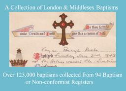
CD 27 Index to a Collection of Middlesex Baptisms (not in the IGI).Jan 2012
Over 123,000 baptisms collected from 94 Baptism or Non-conformist registers. The following places are included, but for some there are only a small number of records: Acton 1539–1689/90 (2167) Acton All Saints South Acton 1872-76 (649) Ashford 1699-1710 & 1760-1876 (1449) Bethnal Green Virginia Congregational Chapel 1825-37 (24) Chelsea Christ Church 1839-1876 (79) …
Supplied by: West Surrey Family History Society Product Ref: WSY-CD27A
Poll Book : Hull : 1832 & 1835
HULL. James Acland’s Comparative Poll Book, being an alphabetical list of the Electors for the Borough of Kingston-upon-Hull and the Votes recorded at the Three Elections of December, 1832, January 1835 and June 1835. This publication is a breakdown of the polls for these three elections, followed by James Acland’s commentary, listing the electors as "timid traitors," "fools," "worse than fools," "neutrals…
Supplied by: Yorkshire Ancestors Product Ref: YAN-GW139