Product Search
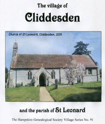
Cliddesden (Village Booklet 91)
The village of Cliddesden and the parish of St Leonard
Supplied by: Hampshire Genealogical Society Product Ref: HAM-16091
Colchester 1801 A3 Map
detailed coloured street map [sent in tube]
Supplied by: The Mclaughlin Guides and Buckinghamshire related books and historic maps Product Ref: BGS-M20
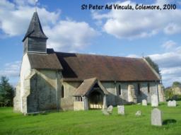
Colemore and Priors Dean (Village Booklet 112)
Villages of Colemore and Priors Dean and the Colemore parish of St Peter Ad Vincula
Supplied by: Hampshire Genealogical Society Product Ref: HAM-16112
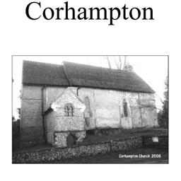
Corhampton (Village Booklet 21)
The village of Corhampton.
Supplied by: Hampshire Genealogical Society Product Ref: HAM-16021
Cork 1851 A3 Map
detailed coloured street map [sent in tube]
Supplied by: The Mclaughlin Guides and Buckinghamshire related books and historic maps Product Ref: BGS-M21
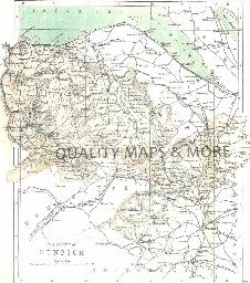
CORK 1882
A QUALITY A3 SIZE COLOUR REPRODUCTION FROM PHILIP'S 1882 ATLAS. LASER PRINTER ON GOOD QUALITY CARTRIDGE PAPER. SENT FOLDED IN A PLASTIC DISPLAY SLEEVE IN A STIFF CARD ENVELOPE AT THE LARGE LETTER RATE. SCALES VARY [WATERMARKS WILL NOT SHOW ON PURCHASES]
Supplied by: Quality Maps and More Product Ref: QMM-MP206
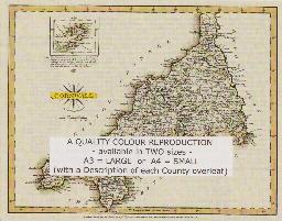
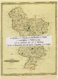
CORNWALL 1787
A QUALITY A3 SIZE COLOUR REPRODUCTION FROM JOHN CARY'S 1787 ATLAS WITH DETAILS OF THE COUNTY OVERLEAF. LASER PRINTER ON GOOD QUALITY CARTRIDGE PAPER. SENT FOLDED IN A PLASTIC DISPLAY SLEEVE IN A STIFF CARD ENVELOPE AT THE LARGE LETTER RATE. SCALES VARY
Supplied by: Quality Maps and More Product Ref: QMM-MP106
Cornwall 1837 A3 County Map
detailed coloured county map [sent in tube]
Supplied by: The Mclaughlin Guides and Buckinghamshire related books and historic maps Product Ref: BGS-M66

Cosham & Wymering 1930
As well as the map there is a local history written by Alan Godfrey and extracts from Kelly's Directory for Hampshire, 1927.
Supplied by: Hampshire Genealogical Society Product Ref: HAM-13966834
County Durham 1837 A3 County Map
detailed coloured county map [sent in tube]
Supplied by: The Mclaughlin Guides and Buckinghamshire related books and historic maps Product Ref: BGS-M71
Coventry 1801 A3 Map
detailed coloured street map [sent in tube].
Supplied by: The Mclaughlin Guides and Buckinghamshire related books and historic maps Product Ref: BGS-M22
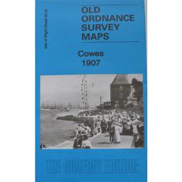
Cowes 1907
As well as the map there is a local history written by Tony Painter and extracts from Kelly's Directory for Hampshire, 1899.
Supplied by: Hampshire Genealogical Society Product Ref: HAM-13966831
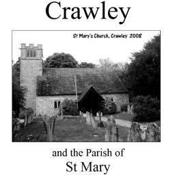
Crawley (Village Booklet 24)
The village of Crawley and the parish of St. Mary.
Supplied by: Hampshire Genealogical Society Product Ref: HAM-16024
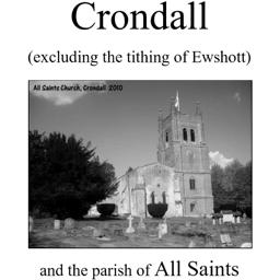
Crondall (Village Booklet 39)
The village of Crondall (excluding the tithing of Ewshott) and the parish of All Saints.
Supplied by: Hampshire Genealogical Society Product Ref: HAM-16039
CUMBERLAND 1787
A QUALITY A3 SIZE COLOUR REPRODUCTION FROM JOHN CARY'S 1787 ATLAS WITH DETAILS OF THE COUNTY OVERLEAF. LASER PRINTER ON GOOD QUALITY CARTRIDGE PAPER. SENT FOLDED IN A PLASTIC DISPLAY SLEEVE IN A STIFF CARD ENVELOPE AT THE LARGE LETTER RATE. SCALES VARY
Supplied by: Quality Maps and More Product Ref: QMM-MP107
Cumberland 1837 A3 County Map
detailed coloured county map [sent in tube]
Supplied by: The Mclaughlin Guides and Buckinghamshire related books and historic maps Product Ref: BGS-M67
Darnall 1903
Map of residential working class area east of central Sheffield.
Supplied by: Sheffield & District Family History Society Product Ref: SHE-G70102
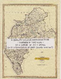
DENBIGH 1883
A QUALITY A3 SIZE COLOUR REPRODUCTION FROM AN 1883 ATLAS. LASER PRINTER ON GOOD QUALITY CARTRIDGE PAPER. SENT FOLDED IN A PLASTIC DISPLAY SLEEVE IN A STIFF CARD ENVELOPE AT THE LARGE LETTER RATE. SCALES VARY
Supplied by: Quality Maps and More Product Ref: QMM-MP415
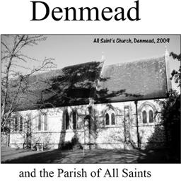
Denmead (Village Booklet 26)
The tithings of Denmead and Ervills with the village of Denmead and the parish of All Saints.
Supplied by: Hampshire Genealogical Society Product Ref: HAM-16026
Derby 1801 A3 Map
detailed coloured street map [sent in tube]
Supplied by: The Mclaughlin Guides and Buckinghamshire related books and historic maps Product Ref: BGS-M23
DERBYSHIRE 1787
A QUALITY A3 SIZE COLOUR REPRODUCTION FROM JOHN CARY'S 1787 ATLAS WITH DETAILS OF THE COUNTY OVERLEAF. LASER PRINTER ON GOOD QUALITY CARTRIDGE PAPER. SENT FOLDED IN A PLASTIC DISPLAY SLEEVE IN A STIFF CARD ENVELOPE AT THE LARGE LETTER RATE. SCALES VARY
Supplied by: Quality Maps and More Product Ref: QMM-MP108
Derbyshire 1837 A3 County Map
detailed coloured county map [sent in tube]
Supplied by: The Mclaughlin Guides and Buckinghamshire related books and historic maps Product Ref: BGS-M68
Derbyshire, Buxton c.1890 Map CD
Stepping Stones publication Buxton c.1890 Map CD
Supplied by: S&N Genealogy Supplies Product Ref: SNG-5091
Devon 1837 A3 County Map
detailed coloured county map [sent in tube]
Supplied by: The Mclaughlin Guides and Buckinghamshire related books and historic maps Product Ref: BGS-M69
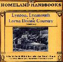
Devon, The Homeland Handbooks - Lynton, Lynmouth and the Lorna Doone Country - Ordnance Map c1900
This guide provides invaluable background information on Lynton, Lynmouth and the Lorna Doone Country in the 1900's. This official council guide has maps, photographs and illustrations. It covers the history, traditions, worthies, antiquities and literary associations. This CD is a useful guide with information and details about the area where your relatives may have lived. \*Digitally…
Supplied by: S&N Genealogy Supplies Product Ref: SNG-3587