Product Search
Hull (Queens Dock) 1853
Dated 1853. Sheet 08. Early Large Scale Maps. This detailed map covers the area around and to the north of Queen's Dock, including Mason Street, Sykes Street, New George Street, Charter House, Kingston Square, Salthouse Lane, Great Union Street, part of Witham, North Bridge and Hodgson Street. Taken from an early engraved OS map it appears a little faint at first, but closer inspection finds a mass…
Supplied by: East Yorkshire Family History Society Product Ref: EYK-G044-GM1
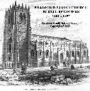
Bradford Parish Church Burial Registers 1681 - 1837
Published June 2009 This publication on CD-ROM, which is also available as a Downloadble PDF file, contains a brief history of the Parish Church (now Bradford Cathedral), transcriptions of the burial registers, and photographs and old images. The transcriptions of the burial registers, presented in same order as in the original registers, include SURNAME, FORENAMES, DESCRIPTION (i.e. items such as…
Supplied by: Bradford Family History Society Product Ref: BFD-CPRBPC
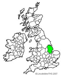
Two Lincolnshire Schools Admission Books: Christ's Hospital School Lincoln 1832-1879 and Boston St Botolph's 1815-1855
Previously published in 1998 as a microfiche, converted to this pdf version in 2024 re formatted 2025. And published as a download only. The admission registers provided a snapshot in time of some early schools’ provision in Lincoln and Boston. Additional admissions can be found in other surviving documents held at the Lincolnshire Archives and listed on their catalogue. Places named in the registers:…
Supplied by: Lincolnshire Family History Society Product Ref: LIN-093D
CD10 The Surrey Burial Index (Non-Metropolitan Parishes)
THE SURREY BURIAL INDEX, compiled by Alan Benny, includes 575,500 burials and covers the period from the start of each Parish Register, mostly up to 1865 (some later) for ALL ANCIENT parishes and many "modern" parishes (created after 1837) in RURAL SURREY. In addition to parish burials the index includes Dorking Cemetery records up to 1999, Godalming (Nightingale) Cemetery records up to 1998…
Supplied by: West Surrey Family History Society Product Ref: WSY-CD10

London Registers Set 4 - 12 Volumes
This CD allows you to browse, search and print transcribed parish records from the following parishes: Volume 1 - St. George, Hanover Square, Marriages, 1725-1787. Volume 2 - St. Dunstan's, Stepney, Marriages, 1568-1639. Volume 3 - St. Dunstan's, Stepney, Marriages, 1640-1696. Volume 4 - St. Dunstan's, Stepney, Marriages, 1697-1719. Volume 5 - St. Mary le Bowe, All Hallows and St. Pancras, Soper Lane,…
Supplied by: S&N Genealogy Supplies Product Ref: SNG-3426
Hampshire Monumental InscriptionsBRAMLEY AREA HMI 04
Bramley St James Hartley Wespall St Mary Monk Sherborne All Sts Mortimer St Saviour Mortimer West End Pamber SS Mary & John Sherfield on Lodden St Leonard Silchester St Mary Stratfield Mortimer St Mary Stratfield Saye St Mary Stratfield Turgis All Sts Sherborne St John St Andrew
Supplied by: Hampshire Genealogical Society Product Ref: HAM-32004
Bromley: Misc' Monumental Inscriptions & Indexes
Beckenham, St George MIs Beckenham, St George PRs: Burials 1538-1976 Bromley, Settlement Examinations 1747-87 & 1816-31 Bromley, Dunns the Undertakers: Name Index to Account Books 1803-39 Bromley Common, Holy Trinity PRs: Burials 1844-1883 Bromley Common, Holy Trinity MIs Bromley Journal, Index to BMD 1869-1885 Chislehurst, St Mary Roman Catholic MIs Chislehurst, St Nicholas PRs: Bap 1559-1880,…
Supplied by: North West Kent Family History Society Product Ref: NWK-CD-MI1v2
CD29 A 2nd Collection of METROPOLITAN Surrey Burials Index (including some Rural parishes)
Transcriptions and indexes. September 2012 An Index of over 247,000 burials - 231,480 from Metropolitan Surrey and 15,522 from Rural Surrey. The following parishes are included: METROPOLITAN SURREY: Battersea Christ Church 1862-1866, (263); Battersea St Mary 1778-1865, (9,266); Bermondsey St James 1829-1854, 1862-1879, (7,595); Bermondsey St Mary Magdalen 1674-1688, 1700-1724/5, 1738/9-1764, 1786-1794,…
Supplied by: West Surrey Family History Society Product Ref: WSY-CD29

Yorkshire, North & East Riding 1909 Post Office Directory
Stepping Stones publication. 1909 North and East Yorkshire This CD contains scanned images of the above Kelly's Directory. Covers the North and East Ridings, but not the cities of York and Hull, which are on separate CDs. Post Office Directory section has 598 pages, listing many towns and villages and giving a description of each place with geographical, historical and Post Office information for each,…
Supplied by: S&N Genealogy Supplies Product Ref: SNG-5040
Leighton Buzzard Parish CD
V 4: Transcripts of Parish Registers 1562-1812 and the 1851 Census Index, with searchable indexes to BAPTISMS: All Saints (1562-1851), Lake Street Baptist (1771-1881), Primitive Methodist (1835-1865), Quaker (1645-1858), Wesleyan (1802-1837), Heath & Reach St Leonard (1813-1852) and Eggington St Michael (1813-1851). MARRIAGES: All Saints (1562-1885), Quakers (1658-1834), L.B. registration district…
Supplied by: Bedfordshire Family History Society Product Ref: BDF-PRCD23
Baptisms at seven Methodist New Connexion Chapels in Sheffield between 1795 and 1988
Full transcriptions of 3,127 baptism records of seven Methodist New Connexion Chapels: Bow Street Chapel (1828-1834), High Greave Chapel Ecclesfield (1902-1988), Owlerton Methodist Church (1879-1963), Potter Hill Chapel Ecclesfield 1858-1964), Scotland Street Chapel (1795-1966), South Street Chapel (1860-1912) and Talbot Street Chapel (1862-1962). The content of the records varies but where recorded…
Supplied by: Sheffield & District Family History Society Product Ref: SHE-G504
Stranraer Old Churchyards Memorial Inscriptions (2014)
This is a 56 page book of Memorial Inscriptions for Stranraer Old Churchyards in Stranraer Town in the Parish of Stranraer, Wigtownshire. It includes Burial Grounds in Bridge Street, Church Street, Dalrymple Street, Ivy Place and Thistle Street. It was published in 2018 and consists of 34 pages of inscriptions from 285 headstones. It is indexed by Surname only. A Location Map of graveyards in Stranraer…
Supplied by: Dumfries and Galloway Family History Society Product Ref: DGF-STROMI-2018

Stranraer Sheuchan Churchyard Memorial Inscriptions Sect 1 (2018)
This is a 68 page book of Memorial Inscriptions for Sheuchan Churchyard in Stranraer Town in the Parish of Leswalt, Wigtownshire. It was re-printed in 2018 and consists of 54 pages of inscriptions from 412 headstones. It is indexed by Surname only. Included is a map of the graveyard, and a location plan of the 7 graveyards in Stranraer. There is a second book for the Sheuchan Churchyard Extension. There…
Supplied by: Dumfries and Galloway Family History Society Product Ref: DGF-STR1MI-2018
Hull East 1908
Dated 1908. Sheet 240.03b. 25in to the mile Three versions of this detailed map have been published (1890, 1908 & 1928), showing how the area developed across the years. It covers much of central Hull, with coverage stretching from Jameson Street and King Edward Street eastward to Wyke Street. Features include Humber Dock, Prince's Dock, Queen's Dock, Victoria Dock, Garrison Side, Earle's Shipbuilding…
Supplied by: East Yorkshire Family History Society Product Ref: EYK-G019-GM1
Hull (East) 1928
Dated 1928. Sheet 240.03c. 25in to the mile Three versions of this detailed map have been published (1890, 1908 & 1928), showing how the area developed across the years. It covers much of central Hull, with coverage stretching from Jameson Street and King Edward Street eastward to Wyke Street. Features include Humber Dock, Prince's Dock, Queen's Dock, Victoria Dock, Garrison Side, Earle's Shipbuilding…
Supplied by: East Yorkshire Family History Society Product Ref: EYK-G020-GM1
York (South) 1907
Dated 1907. Sheet 174.10b. 25in to the mile This detailed map covers the southern part of York. Coverage stretches from Micklegate southward to Campleshon Lane, and from Fawcetts Street westward to New Lane and Murray Street. Features on the map include the southern tip of the station and its railway approaches, including carriage works, engine shed, Holgate Junction (shown in detail with track layout),…
Supplied by: East Yorkshire Family History Society Product Ref: EYK-G041-GM1
Hull (East) 1890
Dated 1890. Sheet 240.03a. 25in to mile, coloured Three versions of this detailed map have been published (1890, 1908 & 1928), showing how the area developed across the years. It covers much of central Hull, with coverage stretching from Jameson Street and King Edward Street eastward to Wyke Street. Features include Humber Dock, Prince's Dock, Queen's Dock, Victoria Dock, Garrison Side, Earle's…
Supplied by: East Yorkshire Family History Society Product Ref: EYK-G047-GM2
Lancashire 1841 Census DVD set
This is the original Census information digitised from high quality microfilm and scanned several times to provide the best possible images. Supplied on DVD as PDF documents with Street and Area Indexes. Covers whole of Lancashire as enumerated at the time, including Liverpool, Manchester and Preston.
Supplied by: S&N Genealogy Supplies Product Ref: SNG-5236
Lancashire 1851 Census DVD set
This is the original Census information digitised from high quality microfilm and scanned several times to provide the best possible images. Supplied on DVD as PDF documents with Street and Area Indexes. Covers whole of Lancashire as enumerated at the time, including Liverpool, Manchester and Preston.
Supplied by: S&N Genealogy Supplies Product Ref: SNG-4098
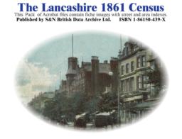
Lancashire 1861 Census
This is the original Census information digitised from high quality microfilm and scanned several times to provide the best possible images. Supplied as Acrobat documents with Street and Area Indexes. Covers whole of Lancashire inc. Liverpool, Manchester and Preston.
Supplied by: S&N Genealogy Supplies Product Ref: SNG-1214
Lancashire 1861 Census DVD Set Free P&P
This is the original Census information digitised from high quality microfilm and scanned several times to provide the best possible images. Supplied on DVD as PDF documents with Street and Area Indexes. Covers whole of Lancashire as enumerated at the time, including Liverpool, Manchester and Preston.
Supplied by: S&N Genealogy Supplies Product Ref: SNG-5800
Lancashire 1871 Census
This is the original Census information digitised from high quality microfilm and scanned several times to provide the best possible images. Supplied on DVD as PDF documents with Street and Area Indexes. Covers whole of Lancashire as enumerated at the time, including Liverpool, Manchester and Preston.
Supplied by: S&N Genealogy Supplies Product Ref: SNG-1215

Lancashire 1881 Census
This is the original Census information digitised from high quality microfilm and scanned several times to provide the best possible images. Supplied on DVD as PDF documents with Street and Area Indexes. Covers whole of Lancashire as enumerated at the time, including Liverpool, Manchester and Preston.
Supplied by: S&N Genealogy Supplies Product Ref: SNG-1216
Lancashire 1891 Census (CD)
This is the original Census information digitised from high quality microfilm and scanned several times to provide the best possible images. Supplied on CD as PDF documents with Street and Area Indexes. Coverage includes: Ashton Under Lyne - Barrow in Furness - Barton Upon Irwell - Blackburn _ Bolton - Burnley - Bury - Chorley - Chorlton - Clitheroe - Fylde - Garstang - Haslingden - Lancaster - Leigh…
Supplied by: S&N Genealogy Supplies Product Ref: SNG-1258
Lancashire 1891 Census (DVD)
This is the original Census information digitised from high quality microfilm and scanned several times to provide the best possible images. Supplied on DVD as PDF documents with Street and Area Indexes. Coverage includes: Ashton Under Lyne - Barrow in Furness - Barton Upon Irwell - Blackburn _ Bolton - Burnley - Bury - Chorley - Chorlton - Clitheroe - Fylde - Garstang - Haslingden - Lancaster - Leigh…
Supplied by: S&N Genealogy Supplies Product Ref: SNG-319