Product Search
Swansea Danygraig 1, Cemetery (Burials 1856 - 1896)
Both CD and Download contain approx 21,500 entries which are indexed alphabetically by Surname, Forename and give Address, Grave No., Date and Register Number.
Supplied by: Glamorgan Family History Society /, Cymdeithas Hanes Teuluol Morgannwg Product Ref: GLA-S1914CD
Merthyr Electoral Registers - Spring 1925
The copy of the 1925 Spring Register of Electors was obtained from Merthyr Tydfil Library and scanned at Aberdare Library. Over 700 scanned pages which have been book-marked by voting ward; and OCR
Supplied by: Glamorgan Family History Society /, Cymdeithas Hanes Teuluol Morgannwg Product Ref: GLA-M0747CD
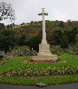
Bridgend Area Cemeteries (11)
Transcription of the Grave Book Registers for the following Bridgend Area Cemeteries. Blaenogwr1888 - 1968, Bridgend1894 - 1968, Cornelly 1925 - 1968, Gelliron 1896 - 1968, Glynogwr 1888 - 1968, Laleston 1980 - 1968, Maesteg 1883 - 1968, Pencoed 1953 - 1968, Porthcaw 1934 - 1968, Pwll y Pant 1887 - 1968 and Sarn 1936 - 1968 Approx 54,000 entries indexed by Grave No.,Surname, Forename, Age and Burial…
Supplied by: Glamorgan Family History Society /, Cymdeithas Hanes Teuluol Morgannwg Product Ref: GLA-B0801CD
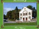
Swansea Dunvant - Ebenezer Chapel
Both CD and Download contain a transcript of the Ebenezer Chapel, Dunvant Grave Register, Monumental Inscriptions + Photos of the Chapel Interior and Memorial Gardens
Supplied by: Glamorgan Family History Society /, Cymdeithas Hanes Teuluol Morgannwg Product Ref: GLA-S1916CD
Swansea Llansamlet, St Samlet
The information contained in the production is the result of a number of years work by members of both the Parish of Llansamlet and a few members of the Glamorgan Family History Society [GFHS]. Due to the timescales and the number of volunteers involved it is impossible to thank everyone involved so thanks are going to the two organisations involved. This publication contains a record of the inscriptions…
Supplied by: Glamorgan Family History Society /, Cymdeithas Hanes Teuluol Morgannwg Product Ref: GLA-S1917CD
Oystermouth Cemetery Burial index
Burial Register Indexes March 1883 - Jan 1941
Supplied by: Glamorgan Family History Society /, Cymdeithas Hanes Teuluol Morgannwg Product Ref: GLA-O0203CD
Swansea, Cwmgelli Cemetery
Contains an A - Z index of Burials between 1896 - 1929 transcribed from the Burial Register of Cwmgelli Cemetery and also has a graveyard plan. The Cemetery is located in the Treboeth area of Swansea.
Supplied by: Glamorgan Family History Society /, Cymdeithas Hanes Teuluol Morgannwg Product Ref: GLA-S1919CD
Penmaen, SS Philip & James's Church (formed from Mynyddislwyn 1845)
Register of Baptisms 1852-1907
Supplied by: Gwent Family History Society /, Cymdeithas Hanes Teuluoedd Gwent Product Ref: GNT-BCD12
Jerusalem British School, Blackwood
Admissions Register 1874-1878. Includes photographs of the local area and a transcription of the Mynyddislwyn district of 1884 from Kelly’s Directory
Supplied by: Gwent Family History Society /, Cymdeithas Hanes Teuluoedd Gwent Product Ref: GNT-GNTB-CD11
Llanhilleth, St Illtyd's Chapel
Baptismal Register 1734-1814
Supplied by: Gwent Family History Society /, Cymdeithas Hanes Teuluoedd Gwent Product Ref: GNT-PB60
New Tredegar, St Dingat's Parish Church
Marriage Register indexes for 1897 to 1940
Supplied by: Gwent Family History Society /, Cymdeithas Hanes Teuluoedd Gwent Product Ref: GNT-BCD51
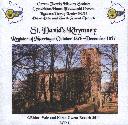
Rhymney Parish Church
Register of Marriages October 1876 till December 1897
Supplied by: Gwent Family History Society /, Cymdeithas Hanes Teuluoedd Gwent Product Ref: GNT-ECD11
Cwmtillery, St Paul's Burial and Monument Records.
The Cd contains the transcribed burial records 1891-2011 and includes images of the burial registers and the grave diggers register and a photographed copy of the Jubilee book by Chris Gwilliam courtesy of the author.
Supplied by: Gwent Family History Society /, Cymdeithas Hanes Teuluoedd Gwent Product Ref: GNT-PCD17
Abergavenny, Our Lady & St Michaels RC Church
Contains transcribed and translated from Latin register of Baptisms from 1837 to 1852 & 1864 to 1896 also Marriages extracted from the Baptisms.
Supplied by: Gwent Family History Society /, Cymdeithas Hanes Teuluoedd Gwent Product Ref: GNT-CCD20
Hampshire Monumental Inscriptions MILFORD ON SEA HMI 77
Monumental Inscriptions are transcriptions recorded by volunteers from grave furniture, including stones, plaques, and windows from churches, churchyards, cemeteries, and burial grounds. They are not transcriptions from a burial register.
Supplied by: Hampshire Genealogical Society Product Ref: HAM-32077
Hampshire Monumental Inscriptions PORTSMOUTH KINGSTON CEMETRY HMI 64
Monumental Inscriptions are transcriptions recorded by volunteers from grave furniture, including stones, plaques, and windows from churches, churchyards, cemeteries, and burial grounds. They are not transcriptions from a burial register.
Supplied by: Hampshire Genealogical Society Product Ref: HAM-32064

Hampshire Monumental Inscriptions PORTSMOUTH MILTON CEMETRY HMI 85
Monumental Inscriptions are transcriptions recorded by volunteers from grave furniture, including stones, plaques, and windows from churches, churchyards, cemeteries, and burial grounds. They are not transcriptions from a burial register.
Supplied by: Hampshire Genealogical Society Product Ref: HAM-32085
Hemingway Journal Back Issues for 2000/2001
Back issue pack of the Autumn and Spring Hemingway (and variants) 2000/2001. The two Journals include Huddersfield Burials, Commonwealth War Graves, Extract of Palmers Index to The Times, some London Parish Register Extracts, Abraham Hemingway, Tried for Sacrilege, Descendents of Joseph Hemingway of Thornhill, Edmund Hemingway - an obituary and much more.
Supplied by: Hemingway One-Name Study, The Product Ref: HEM-04
Aston: The Parish Church of St Mary
Hertfordshire Monumental Inscriptions Series Volume 27 republished in 2022. A 66 page A5 book containing transcriptions made in 1988 and updated in 2021 of monumental inscriptions in the Church and Churchyard and on the War Memorial, plus those recorded by W. B. Gerish c1910 and J. E. Cussans c1870 but not found in 1988 or 2021. There is also a list extracted from the Parish Register of those buried…
Supplied by: Hertfordshire Family History Society Product Ref: HRT-MI027
Hertfordshire Burial index 1800-1851
The Hertfordshire Burial Index holds 137,000 names and is complete for the years 1800-1851. It includes all known Parish Register entries plus Burials from Non-Conformist Churches and Chapels. Full transcriptions from all known deposited registers for the County with information not included on the National Burial Index.
Supplied by: Hertfordshire Family History Society Product Ref: HRT-CD01
Quakers in Kent - Some Birth, Marriage, Burial and Other Records 1648-1806
A complete transcript of a Quaker register not surrendered to the Registrar General in 1837, which covers the period 1648-1778 and includes entries from a number of places in mid- to south-east Kent. Also Quaker burials at Cranbrook 1708-1806, other stray Quaker items from parish registers and Quakers Affirmation rolls of 1723. Introduction, Select Bibliography, Indexes of Surnames and Places. Paperback,…
Supplied by: Kent Family History Research Product Ref: KFH-6-6
Boston Union Workhouse Records volume 1
Extracts from the Minutes of the Board of Guardians 1836-1901; Clerk's Letter Book (transcription of all letters that mention paupers by name) 1887-1890 & 1898-1900; Girls' School Admission & Discharge Registers 1850-1901; Boys' School Admission & Discharge Register 1868-1902. These school registers give; name & age of child, parish to which they are chargeable, date of admission &…
Supplied by: Lincolnshire Family History Society Product Ref: LIN-021C
Kent Administrations in the Prerogative Court of Canterbury 1801-1810
The Prerogative Court of Canterbury (PCC) had superior jurisdiction for probate purposes over the south of England from the 14th century until it, and all the other church courts, were abolished in January 1858 and the Principal Probate Registry was founded. The PCC dealt with the grants of probate of wills and letters of administration (admons) of the estates of intestates of those who had goods worth…
Supplied by: Kent Family History Research Product Ref: KFH-13970759
Lincolnshire Nonconformists 1
Contains Dissenters' Certificates 1740-1852. Places of worship other than Church of England, were required to be licensed by the Bishop. The certificates state whose house or whose property could be used for worship. Nonconformist Marriages 1647-1845.These are mainly Quaker with dates of marriage ranging from 1647 to 1836. Baptist, seven marriages from The General Baptist Church, Killingholme 1708…
Supplied by: Lincolnshire Family History Society Product Ref: LIN-010C
Calcewaithe & Candleshoe Deanery Baptisms & Burials 1754-1812
Includes the parishes of: Addlethorpe, Alford, Anderby, Authorpe, Beesby, Belleau, Bilsby, Bratoft, Burgh le Marsh, Claxby by Alford, Croft, Cumberworth, Farlesthorpe, Friskney, Gayton le Marsh, Gunby St. Peter, Hannah cum Hagnaby, Hogsthorpe, Huttoft, Ingoldmells, Irby in the Marsh, Mablethorpe, Maltby le Marsh, Markby, Mumby, North Reston, Orby, Rigsby, Saleby, Skegness, South Reston, South Thoresby,…
Supplied by: Lincolnshire Family History Society Product Ref: LIN-019C