Product Search
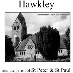
Hawkley (Village Booklet 65)
The village of Hawkley and the parish of St Peter & St Paul.
Supplied by: Hampshire Genealogical Society Product Ref: HAM-16065
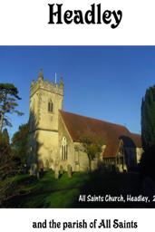
Headley (Village Booklet 104)
The Village of Headley and the parish of All Saints
Supplied by: Hampshire Genealogical Society Product Ref: HAM-16104
Hereford 1801 A3 Map
detailed coloured street map [sent in tube]
Supplied by: The Mclaughlin Guides and Buckinghamshire related books and historic maps Product Ref: BGS-M32
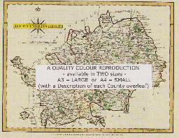
HEREFORDSHIRE 1787
A QUALITY A3 SIZE COLOUR REPRODUCTION FROM JOHN CARY'S 1787 ATLAS WITH DETAILS OF THE COUNTY OVERLEAF. LASER PRINTER ON GOOD QUALITY CARTRIDGE PAPER. SENT FOLDED IN A PLASTIC DISPLAY SLEEVE IN A STIFF CARD ENVELOPE AT THE LARGE LETTER RATE. SCALES VARY
Supplied by: Quality Maps and More Product Ref: QMM-MP115
Herefordshire 1837 A3 County Map
detailed coloured county map [sent in tube]
Supplied by: The Mclaughlin Guides and Buckinghamshire related books and historic maps Product Ref: BGS-M75
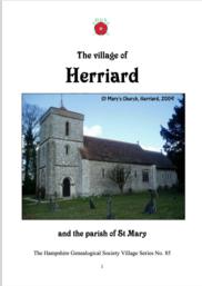
Herriard (Village Booklet 85)
The village of Herriard and the parish of St Mary
Supplied by: Hampshire Genealogical Society Product Ref: HAM-16085
HERTFORDSHIRE 1787
A QUALITY A3 SIZE COLOUR REPRODUCTION FROM JOHN CARY'S 1787 ATLAS WITH DETAILS OF THE COUNTY OVERLEAF. LASER PRINTER ON GOOD QUALITY CARTRIDGE PAPER. SENT FOLDED IN A PLASTIC DISPLAY SLEEVE IN A STIFF CARD ENVELOPE AT THE LARGE LETTER RATE. SCALES VARY
Supplied by: Quality Maps and More Product Ref: QMM-MP116
Hertfordshire 1837 A3 County Map
detailed coloured county map [sent in tube]
Supplied by: The Mclaughlin Guides and Buckinghamshire related books and historic maps Product Ref: BGS-M76
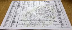
Hertfordshire and its Ancient Parishes at the end of the 19th century.
This map shows not only the parishes of Hertfordshire but also selected parishes in the adjacent counties. There is also a listing of the parishes with a simple grid reference system to help locate them on the map. A3 in size (397 by 420mm) - folded in half for dispatch
Supplied by: Hertfordshire Family History Society Product Ref: HRT-MAP7
High Green and Thorncliffe 1903
Map of industrial village on northern edge of Sheffield.
Supplied by: Sheffield & District Family History Society Product Ref: SHE-G70109
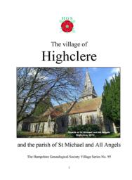
Highclere (Village Booklet 95)
The Village of Highclere and the parish of St Michael and All Angels
Supplied by: Hampshire Genealogical Society Product Ref: HAM-16095
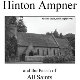
Hinton Ampner (Village Booklet 4)
The village of Hinton Ampner and the parish of All Saints.
Supplied by: Hampshire Genealogical Society Product Ref: HAM-16004
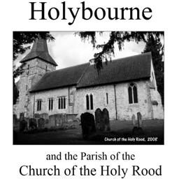
Holybourne (Village Booklet 19)
The village of Holybourne and the parish of the Church of the Holy Rood.
Supplied by: Hampshire Genealogical Society Product Ref: HAM-16019
Hornsea 1926
Dated 1926. Sheet 197.03. 25in to the mile This detailed map covers the small town of Hornsea, a few miles east of Hull. The town lies between Hornsea Mere, part of which is shown on the map, and the sea. A port at Hornsea Beck, just east of the town, was destroyed by coastal erosion in the 16th century, but Hornsea developed as a modest seaside resort with the arrival of the railway in 1864. This…
Supplied by: East Yorkshire Family History Society Product Ref: EYK-G014-GM1
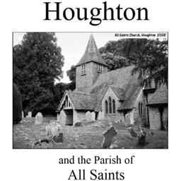
Houghton (Village Booklet 16)
The village of Houghton and the parish of All Saints.
Supplied by: Hampshire Genealogical Society Product Ref: HAM-16016
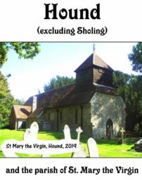
Hound (Village Booklet 105)
The Village of Hound and the parish of St Mary the Virgin
Supplied by: Hampshire Genealogical Society Product Ref: HAM-16105
Hull (East) 1890
Dated 1890. Sheet 240.03a. 25in to mile, coloured Three versions of this detailed map have been published (1890, 1908 & 1928), showing how the area developed across the years. It covers much of central Hull, with coverage stretching from Jameson Street and King Edward Street eastward to Wyke Street. Features include Humber Dock, Prince's Dock, Queen's Dock, Victoria Dock, Garrison Side, Earle's Shipbuilding…
Supplied by: East Yorkshire Family History Society Product Ref: EYK-G047-GM2
Hull (East) 1928
Dated 1928. Sheet 240.03c. 25in to the mile Three versions of this detailed map have been published (1890, 1908 & 1928), showing how the area developed across the years. It covers much of central Hull, with coverage stretching from Jameson Street and King Edward Street eastward to Wyke Street. Features include Humber Dock, Prince's Dock, Queen's Dock, Victoria Dock, Garrison Side, Earle's Shipbuilding…
Supplied by: East Yorkshire Family History Society Product Ref: EYK-G020-GM1
Hull (Hessle Road) 1890
Dated 1890. 25in to mile, coloured Two versions of this map have been published (1890 & 1928), showing how the area changed across the years. The 1890 version is in full colour, taken from the beautiful handcoloured 1st Edition OS map. The maps cover the southwestern area of Hull along Hessle Road and including several of the docks. Coverage stretches from Hawthorn Avenue eastward to the Albert Dock…
Supplied by: East Yorkshire Family History Society Product Ref: EYK-G049-GM2
Hull (North East) 1908
Dated 1908. Sheet 226.15. 25in to the mile This detailed map covers the busy NE area of Hull, with coverage stretching from Cannon Street station northward to Lorraine Street, and from St Paul's Street eastward to New Bridge Road. Holderness Road runs through the map, as does a winding portion of the River Hull, lined with mills, wharves and factories. Features on the map include stretches of the Hull…
Supplied by: East Yorkshire Family History Society Product Ref: EYK-G022-GM1
Hull (North West) 1909
Dated 1909. Sheet 226.14. 25in to the mile This detailed map covers the busy NW area of Hull, with coverage stretching from Perth Street and Richmond Street eastward to Waterloo Street, and from Welbeck Street northward to Torrington Street. This is a mainly residential area with many streets of terraces. Features include Pearson's Park, Beverley Road station, tramways, Sculcoates Workhouse, Stepney…
Supplied by: East Yorkshire Family History Society Product Ref: EYK-G023-GM1
Hull (Prospect Street) 1853
Dated 1853. Sheet 07. Early Large Scale Maps This detailed map covers the area around Prospect Street, stretching from College Street West eastward to Bond Street, and from Liddell Street southward to Temperance Street. Features include the General Infirmary, Waltham Street Chapel, Savings Bank School, Hull Ragged & Industrial School, St Stephen's church, West Street Brewery, and many streets of terraces…
Supplied by: East Yorkshire Family History Society Product Ref: EYK-G046-GM1
Hull (Queens Dock) 1853
Dated 1853. Sheet 08. Early Large Scale Maps. This detailed map covers the area around and to the north of Queen's Dock, including Mason Street, Sykes Street, New George Street, Charter House, Kingston Square, Salthouse Lane, Great Union Street, part of Witham, North Bridge and Hodgson Street. Taken from an early engraved OS map it appears a little faint at first, but closer inspection finds a mass…
Supplied by: East Yorkshire Family History Society Product Ref: EYK-G044-GM1
Hull (Railway Dock & Paragon Station) 1853
Dated 1853. Sheet 11. Early Large Scale Maps. This detailed map covers the area from Railway Dock northward to Paragon station, and westward to Wellington Lane. It shows great detail, even including outhouses and garden paths. Paragon station is shown and other features include Master Mariners Alms Houses, Queen's Theatre, Great Thornton Street Chapel, Trinity Chapel, St John's church (Myton), Julian…
Supplied by: East Yorkshire Family History Society Product Ref: EYK-G045-GM1
Hull (West) 1890
Dated 1890. Sheet 240.02a. 25in to mile, coloured Three versions of this detailed map have been published (1890, 1908 & 1928), showing how the area developed across the years. The 1890 map is colour printed, from the beautiful OS handcoloured First Edition. The map covers a very busy area of west Hull, with coverage stretching from Albert Avenue and Plane Street eastward to Prospect Street and Paragon…
Supplied by: East Yorkshire Family History Society Product Ref: EYK-G048-GM2