Product Search
'Not Having the Fear of God Before Her Eyes' - Ashton and Sale History Society Occasional Paper 6
The Scandals and Quarrels of the Masseys of Sale, and Their Descendants - Margaret Massey (the black ewe of the family), the quarrel with the Reverend Ralph Stirrop over the Massey family pew in the parish church, Richard Massey and Sir William Brereton’s Duck Decoy, James and Richard Massey in the English Civil Wars, The Reverend Hugh Hobson’s Marriage to Mary Massey, The Last Massey Esquire at Sale…
Supplied by: Northern Writers Advisory Services Product Ref: NWA-ASH30
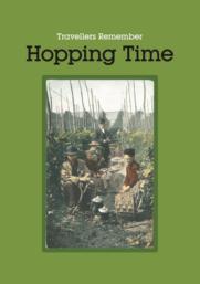
Travellers Remember Hopping Time - now reduced in price!
Edited by Janet Keet-Black and the late Mary Horner A5 paperback book, 60 pages, black-and-white family photographs The book contains people's memories and photos of when they or their older family members used to go hop-picking plus articles about the history of the craft. All these were originally contributed by RTFHS members for a special hopping exhibition held in 2001 at the RTFHS Society Day…
Supplied by: Romany and Traveller Family History Society Product Ref: ROM-HOPPING
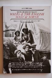
Ten Major Gypsy Families of Wales & The English West & North
Ten Major Gypsy Families of Wales & The English West & North - as its title implies - brings together the family trees of 10 families, grouped by the region of Britain in which they originated, lived and travelled and – no doubt in some cases – associated with each other and intermarried. The result is a book that is very different in format to the previous 17 single-surname volumes in the…
Supplied by: Romany and Traveller Family History Society Product Ref: ROM-FAM-01
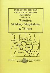
Somerset 1841 Census Index - Vol 16
Taunton St Mary Magdalene and Wilton
Supplied by: Somerset & Dorset Family History Society Product Ref: SAD-816
Somerset 1891 Census Index - Vol 16
Taunton St Mary Magdalene and Wilton
Supplied by: Somerset & Dorset Family History Society Product Ref: SAD-916
Taunton Burial Index, 1813 - 1837
Burial Index for Taunton - St Mary Magdalene and Taunton - St James
Supplied by: Somerset & Dorset Family History Society Product Ref: SAD-556
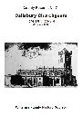
CS071 Salisbury Churchgoers 1574, 1584, & 1600 & Wilton c 1639
People attending St Thomas, Salisbury & St Mary Wilton A4 softback 56 pages
Supplied by: Wiltshire Family History Society Product Ref: WIL-CS071
CS064 Marlborough Records Vol 5
Apprentices, Bastardy, Bonds, Settlements & Valuations, St Mary's Parish, 17th - 19th centuries. A4 softback 84 pages
Supplied by: Wiltshire Family History Society Product Ref: WIL-CS064
CMB03 - Tisbury area, 11 parishes
This CD contains a single pdf file and requires no installation. See 'Download Details' below for information about the file. It includes baptism, marriage and burial transcripts from the earliest entries to 1837 for these parishes: Alvediston, Ansty, Berwick St John, Donhead St Andrew, Donhead St Mary, Ebbesbourne Wake, Fonthill Gifford, Semley, Swallowcliff, Tisbury & Tollard Royal. Details of…
Supplied by: Wiltshire Family History Society Product Ref: WIL-CMB03

CMB24 - Devizes
This CD contains a single pdf file and requires no installation. See 'Download Details' below for information about the file. It includes baptism, marriage and burial transcripts from the earliest entries to 1837 for these parishes: Devizes St John, Devizes St Mary & Devizes Southbroom. Details of all of our publications, including the start year for each parish transcript, are given in our Publications…
Supplied by: Wiltshire Family History Society Product Ref: WIL-CMB24

CMB27 - Marlborough area
This CD contains a single pdf file and requires no installation. See 'Download Details' below for information about the file. It includes baptism, marriage and burial transcripts from the earliest entries to 1837 for these parishes: Fyfield (with Overton), Marlborough St Mary, Marlborough St Peter & Preshute. Details of all of our publications, including the start year for each parish transcript,…
Supplied by: Wiltshire Family History Society Product Ref: WIL-CMB27
CS122 Churchwardens Presentments 1662 Vol 3
50 parishes in area between Amesbury, Laverstock, Martin & Tisbury The Churchwardens Presentments 1662 offer a unique insight into problems after the Restoration. A4, 32 pages. These are answers to a questionnaire sent to each parish prior to the Bishop's Visitation, when churchwardens or other parishioners were required to cover a wide range of business, and they are an important source for both…
Supplied by: Wiltshire Family History Society Product Ref: WIL-CS122

CMB15 - Steeple Ashton, West Lavington and 9 other parishes
This CD contains a single pdf file and requires no installation. See 'Download Details' below for information about the file. It includes baptism, marriage and burial transcripts from the earliest entries to 1837 for these parishes: East Coulston, Edington, Erlestoke, Great Cheverell, Imber, Little Cheverell, Orcheston St George, Orcheston St Mary, Steeple Ashton, Tilshead & West Lavington. Details…
Supplied by: Wiltshire Family History Society Product Ref: WIL-CMB15
CMB36 - Eight parishes north and west of Swindon
This CD contains a single pdf file and requires no installation. See 'Download Details' below for information about the file. It includes baptism, marriage and burial transcripts from the earliest entries to 1837 for these parishes: Ashton Keynes, Cricklade St Mary, Cricklade St Sampson, Latton, Leigh, Purton, Robourne Cheney and Swindon Christ Church. Details of all of our publications, including…
Supplied by: Wiltshire Family History Society Product Ref: WIL-CMB36
MI02 Guildford & Stoke Monumental Inscriptions
GUILDFORD Holy Trinity Churchyard. The dates of the inscriptions range from 1562 to 1874. GUILDFORD St Mary. The dates of the inscriptions range from 1741 to 1878 STOKE-next-GUILDFORD St.John. The dates of the inscriptions range from 1753 to 1902. Since that date burials have been transferred to STOKE Cemetery in Stoughton Road.
Supplied by: West Surrey Family History Society Product Ref: WSY-MS-MI2
MI05 Ockham & Ockley Monumental Inscriptions
OCKHAM St.Mary Church and Churchyard. The inscriptions date from 1654 to 1980. OCKLEY St.Margaret Church and Churchyard. The dates of the inscriptions range from 1661 to 1977.
Supplied by: West Surrey Family History Society Product Ref: WSY-MI05
MI07 South of Guildford Monumental Inscriptions - Shalford, Wonersh, Hascombe & Bramley
SHALFORD St. Mary the Virgin Church and Churchyard. The dates of the inscriptions range from 1613 to 1933. WONERSH St John the Baptist Church and Churchyard. The dates of the inscriptions range from 1467 to 1977. HASCOMBE St. Peter Church and Churchyard. The dates of the inscriptions range from 1742 to 1978. BRAMLEY Holy Trinity Church and Churchyard. The dates of the inscriptions range from 1709 to…
Supplied by: West Surrey Family History Society Product Ref: WSY-MI07
CD28 Marlborough records
Six books from our A4 County series of publications, available individually on page 11, presented here on a CD-ROM or as a single pdf file as a download. The books are: 60 Volume 1; Vagrants & Deserters 18th & 19th centuries 61 Volume 2; Petty Sessions Courts 1771-1857 62 Volume 3; Removals & Settlements 19th C 63 Volume 4; Borough apprentices 17C, St Peter & Paul bastardy records 17-18thC,…
Supplied by: Wiltshire Family History Society Product Ref: WIL-CD28
CD34 Compendium of Parish A5 series volumes 1 to 20
This product is both a CD-ROM and download. It contains volumes 1 to 20 of our A5 Parish Series, which are: 1 Great Bedwyn Families In The 19th Century 2 Collingbourne Ducis Families In The 19th Century 3 Tisbury & Wardour 1835 Census 4 Leigh Delamere & Sevington People In The 19th Century 5 Holt People In The Early 19th Century 6 Stourton Poor In The 19th Century 7 Devizes St. Mary Survey…
Supplied by: Wiltshire Family History Society Product Ref: WIL-CD34
CD14 Wiltshire Non-Conformist Index
This publication is a re-release of previously published information. Volunteers are currently revising and adding in additional material from other sources for non-conformist records held in Wiltshire. There is considerable work to be completed and although it is hoped to be able to publish this in the future, no publication date can yet be proposed. The registers of the Wiltshire nonconformist chapels…
Supplied by: Wiltshire Family History Society Product Ref: WIL-CD14
CD08 The Guildford Collection
The contents of this CD include: Parish Registers of Holy Trinity, St Mary's and St Nicolas Guildford, Stoke-next-Guildford and Worplesdon. Marriages to 1837, Baptisms to 1840 and Burials to 1865. Census Indexes - 1851 and 1861 for the above parishes plus Merrow. 1891 and 1901 Census Indexes for Worplesdon. 1801 Census for Guildford and a 1790 Poll Book for Guildford - transcribed and with Index of…
Supplied by: West Surrey Family History Society Product Ref: WSY-CD08
MI12 Croydon various Monumental Inscriptions
CROYDON St James; St Peter; Christ Church; Pump Pail Chapel; Friends Burial Ground; SHIRLEY: St Stephen; ADDINGTON: St Mary. This listing has been produced from "Croydon in the Past" published in 1884.
Supplied by: West Surrey Family History Society Product Ref: WSY-MI12
Guildford Indexed Parish Register Transcriptions
Holy Trinity - Baptisms 1558-1840, Marriages 1558-1837, Burials 1558-1865 St Mary - Baptisms 1540-1840, Marriages 1540-1837, Burials 1540-1865 St Nicholas - Baptisms 1562-1840, Marriages 1561-1837, Burials 1562-1865 Stoke Next Guildford - Baptisms 1662-1840, Marriages 1662-1837, Burials 1662-1865
Supplied by: West Surrey Family History Society Product Ref: WSY-Guildford
MI06 West of Guildford Monumental Inscriptions - Compton, Peper Harow, Tilford, Wanborough, Worplesdon
COMPTON St. Nicholas Church and Churchyard. The dates of the inscriptions range from 1694 to 1940 PEPER HAROW St. Nicholas Church and Churchyard. The dates of the inscriptions range from 1487 to 1865 Only inscriptions relating to pre 1900 deaths or pre 1840 dates of birth were copied. TILFORD All Saints Church and Churchyard. The copy covers dates 1881 to 1977. WANBOROUGH St.Bartholomew Churchyard.…
Supplied by: West Surrey Family History Society Product Ref: WSY-MI06
CD20 Index of Burials in London and Middlesex. Nov 2010
AN INDEX OF BURIALS IN LONDON & MIDDLESEX, covering 52 parishes. Nearly 58,000 burials (NOT INCLUDED IN THE National Burial Index) .Parishes, dates and number of records as follows: Ashford 1700 –06/7, 1760 –1870 (666); Christ Church Greyfriars, (City) 1639-39/40 (98); Clerkenwell: St Barnabas, 1842-54 (82); Clerkenwell: St Thomas Charterhouse 1846-54 (472); Cowley 1562–1876 (1617); Cranford 1566–186…
Supplied by: West Surrey Family History Society Product Ref: WSY-CD20