Product Search
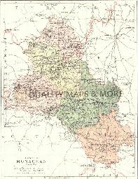
MONAGHAN 1882
A QUALITY A3 SIZE COLOUR REPRODUCTION FROM PHILIP'S 1882 ATLAS. LASER PRINTER ON GOOD QUALITY CARTRIDGE PAPER. SENT FOLDED IN A PLASTIC DISPLAY SLEEVE IN A STIFF CARD ENVELOPE AT THE LARGE LETTER RATE. SCALES VARY [WATERMARKS WILL NOT SHOW ON PURCHASES]...
Supplied by: Quality Maps and More Product Ref: QMM-MP223
Monk Sherborne (Village Booklet 55)
The village of Monk Sherborne and the parish of All Saints...
Supplied by: Hampshire Genealogical Society Product Ref: HAM-16055
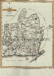
MONMOUTHSHIRE 1787
A QUALITY A3 SIZE COLOUR REPRODUCTION FROM JOHN CARY'S 1787 ATLAS WITH DETAILS OF THE COUNTY OVERLEAF. LASER PRINTER ON GOOD QUALITY CARTRIDGE PAPER. SENT FOLDED IN A PLASTIC DISPLAY SLEEVE IN A STIFF CARD ENVELOPE AT THE LARGE LETTER RATE. SCALES VARY...
Supplied by: Quality Maps and More Product Ref: QMM-MP123
Monmouthshire 1837 A3 County Map
detailed coloured map [sent in tube]...
Supplied by: The Mclaughlin Guides and Buckinghamshire related books and historic maps Product Ref: BGS-M84
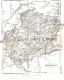
MONTGOMERY 1883
A QUALITY A3 SIZE COLOUR REPRODUCTION FROM AN 1883 ATLAS. LASER PRINTER ON GOOD QUALITY CARTRIDGE PAPER. SENT FOLDED IN A PLASTIC DISPLAY SLEEVE IN A STIFF CARD ENVELOPE AT THE LARGE LETTER RATE. SCALES VARY...
Supplied by: Quality Maps and More Product Ref: QMM-MP419
Mottisfont (Village Booklet 46)
The village of Mottisfont and the parish of St. Andrew...
Supplied by: Hampshire Genealogical Society Product Ref: HAM-16046
Nether Edge 1903
Map of suburb to south of central Sheffield....
Supplied by: Sheffield & District Family History Society Product Ref: SHE-G70112
Nether Wallop (Village Booklet 51)
The village of Nether Wallop and the parish of St. Andrew...
Supplied by: Hampshire Genealogical Society Product Ref: HAM-16051
Newcastle & Gateshead 1801 A3 Map
detailed coloured street map [sent in tube]...
Supplied by: The Mclaughlin Guides and Buckinghamshire related books and historic maps Product Ref: BGS-M42
Newcastle & Gateshead c.1890 Map CD
Stepping Stones publication Newcastle and Gateshead c.1890 Map CD...
Supplied by: S&N Genealogy Supplies Product Ref: SNG-5129
Newcastle 1851 A3 Map
detailed coloured street map [sent in tube]...
Supplied by: The Mclaughlin Guides and Buckinghamshire related books and historic maps Product Ref: BGS-M43
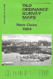
Newquay Town Plan (1904)
A detailed plan of Newquay at the start of the 20th century...
Supplied by: Cardiganshire Family History Society, Cymdeithas Hanes Teuluoedd Ceredigion Product Ref: CGN-W18
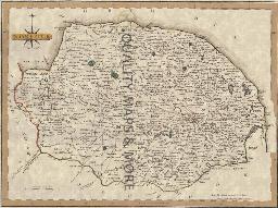
NORFOLK 1787
A QUALITY A3 SIZE COLOUR REPRODUCTION FROM JOHN CARY'S 1787 ATLAS WITH DETAILS OF THE COUNTY OVERLEAF. LASER PRINTER ON GOOD QUALITY CARTRIDGE PAPER. SENT FOLDED IN A PLASTIC DISPLAY SLEEVE IN A STIFF CARD ENVELOPE AT THE LARGE LETTER RATE. SCALES VARY...
Supplied by: Quality Maps and More Product Ref: QMM-MP124
Norfolk 1837 A3 County Map
detailed coloured map [sent in tube]...
Supplied by: The Mclaughlin Guides and Buckinghamshire related books and historic maps Product Ref: BGS-M85
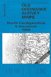
North Cardiganshire & Aberystwyth (1909)
Sheet 163, showing the area around Aberystwyth, Aberdovey and the Dovey estuary. On the reverse is a large scale plan of Borth in 1904, and an essay on the history of the area by Alan Leather....
Supplied by: Cardiganshire Family History Society, Cymdeithas Hanes Teuluoedd Ceredigion Product Ref: CGN-W09
Northampton 1801 A3 Map
detailed coloured street map [sent in tube]...
Supplied by: The Mclaughlin Guides and Buckinghamshire related books and historic maps Product Ref: BGS-M44
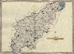
NORTHAMPTONSHIRE 1787
A QUALITY A3 SIZE COLOUR REPRODUCTION FROM JOHN CARY'S 1787 ATLAS WITH DETAILS OF THE COUNTY OVERLEAF. LASER PRINTER ON GOOD QUALITY CARTRIDGE PAPER. SENT FOLDED IN A PLASTIC DISPLAY SLEEVE IN A STIFF CARD ENVELOPE AT THE LARGE LETTER RATE. SCALES VARY...
Supplied by: Quality Maps and More Product Ref: QMM-MP125
Northamptonshire 1837 A3 County Map
detailed coloured map [sent in tube]...
Supplied by: The Mclaughlin Guides and Buckinghamshire related books and historic maps Product Ref: BGS-M86
Northington and Swarraton (Village Booklet 18)
The village of Northington and Swarraton and the parish of St. John the Evangelist...
Supplied by: Hampshire Genealogical Society Product Ref: HAM-16018
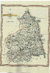
NORTHUMBERLAND 1787
A QUALITY A3 SIZE COLOUR REPRODUCTION FROM JOHN CARY'S 1787 ATLAS WITH DETAILS OF THE COUNTY OVERLEAF. LASER PRINTER ON GOOD QUALITY CARTRIDGE PAPER. SENT FOLDED IN A PLASTIC DISPLAY SLEEVE IN A STIFF CARD ENVELOPE AT THE LARGE LETTER RATE. SCALES VARY...
Supplied by: Quality Maps and More Product Ref: QMM-MP126
Northumberland 1837 A3 County Map
detailed coloured map [sent in tube]...
Supplied by: The Mclaughlin Guides and Buckinghamshire related books and historic maps Product Ref: BGS-M87
Norwich 1801 A3 Map
detailed coloured street map [sent in tube]...
Supplied by: The Mclaughlin Guides and Buckinghamshire related books and historic maps Product Ref: BGS-M45
Norwich 1866 A3 Map
detailed coloured street map [sent in tube]...
Supplied by: The Mclaughlin Guides and Buckinghamshire related books and historic maps Product Ref: BGS-M46
Nottingham 1828 A3 Map
detailed coloured street map [sent in tube]...
Supplied by: The Mclaughlin Guides and Buckinghamshire related books and historic maps Product Ref: BGS-M47
Nottingham c.1895 Map CD
Stepping Stones publication Nottingham c.1895 Map CD...
Supplied by: S&N Genealogy Supplies Product Ref: SNG-5131